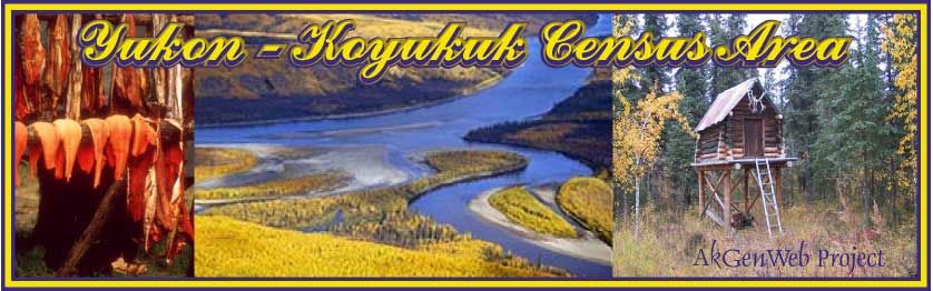

TOWNS,
VILLAGES & POPULATED PLACES
|
|
|
|
TOWNS,
VILLAGES & POPULATED PLACES
|
| Alatna History: Eskimo village established by Archdeacon Stuck (1914, p70) at an old trading post called Marsan. See Allakaket. Description: On the N bank of the Koyukuk River 1 mi downstream from the confluence of the Alatna River with the Koyukuk River and 0.5 mi W of the village of Allakaket Alexanders Village History: Local name obtained in 1956 by U.S. Geological Survey (USGS). Description: 0.4 mi. W of Shovun Lake and 17 mi. NW of Fort Yukon, Yukon Flats. Named after a local trapper, Sam Alexander. Allakaket History: Koyukuk Indian name meaning "mouth of the Alatna (River)," borrowed in 1906 by Archdeacon Stuck (1914, p. 70). He wrote "I was again impressed with the eligibility of that spot as a mission site. It was but ten miles above the present native village (Moses Village), and with church and school established, the whole population would sooner or later move to it. Moreover, the Alatna River is the highway between the Kobuk and the Koyukuk * * *. I foresaw two villages, * * * one clustered about the church (Allakaket; Indian) * * * the other lower down on the opposite side of the river. (Alatna; Eskimo) * * * so I staked a mission site * * * almost opposite the mouth of the Alatna, which, in the native tongue, is 'Allakaket' or 'Allachaket'." A post office was originally established in 1925 as Alatna, but it was changed to Allakaket in 1938 (Ricks 1965, p. 3). Description: On the S side of the confluence of the Alatna River with the Koyukuk River, approximately 34 mi SW of Bettles and 0.5 mi E of the village of Alatna, Kanuti Flats. Anvik History: Ingalik village where Andrei Glazanov found several hundred people when he visited there in January 1834. Recorded by the Russians as "Anvig" or Anvik." A post office, first called "Anvick", was established here in 1897. Description: population 120, on right bank of Yukon River, at mouth of Anvik River, 34 mi. N of Holy Cross, Nulato Hills. Arctic City (historical) History: This was once one of the largest Koyukuk Indian villages on the river. It was named "Moses Village" for the Indian chief "Moses", by prospectors about 1897. Archdeacon Stuck (1917, p. 328) wrote "a road-house and a store turned it from 'Moses Village' to 'Arctic City' when the mail trail from Tanana reached the Koyukuk at that point, but store and road-house and Indian are alike gone some twelve miles up (to Allakaket)." Description: site of Indian village, on right bank of Koyukuk River, opposite mouth of Kanuti River Arctic Village History: Indian village reported in 1926 by Mertie (in Smith. P. S., 1929, pl. 1), U.S. Geological Survey (USGS). Its population in 1930 was 40; the village had a post office in 1909-10 named "Arctic" and a new one in 1959 under the present name. Description: population 110, on E bank of East Fork Chandalar River, 6 mi. SW of junction of Junjik River, Brooks Range Baker History: Telegraph station established in 1903 by the U.S. Army Signal Corps. It was later a sawmill and river boat landing. Description: on right bank of Tanana River at mouth of Baker Creek, Yukon-Tanana High. Beaver History: Eskimo and Indian village originally established about 1906 as a river landing. About 1911 Alaska Road Commission (ARC) built a trail from the "Chandalar diggins" to the Yukon River here. With the expectation of much travel and town growth a town site was staked and many cabins built. The "Chandalar quartz" did not prove productive and the place reverted to a "native village" with a post office, established in 1913, and trading post to serve the Yukon in that area. Its population was 103 in 1930; 88 in 1939; and 101 in 1950. Description: population 101, on N bank of Yukon River, 17 mi. NE of mouth of Beaver Creek and 60 mi. SW of Fort Yukon, Yukon Flats. Located on USGS Beaver B-1 map. Beaver No information available. Located on USGS Fort Yukon B-6 map. Bergman (historical) History: named by prospectors for the operator of the trading post; reported in 1899 by T. G. Gerdine (in Schrader, 1900, pl. 60), U.S. Geological Survey (USGS). height of the Koyukuk gold rush because it was a transfer point for supplies and was situated near the head of navigation for the larger riverboats on Koyukuk. abandoned on 1913 map. Description: site of village on N bank of Koyukuk River NE of its junction with Kanuti River, 7.5 mi. SE of Allakalet; Hogatza High. Bettles History: The community was originally located just downstream of the junction of John River and the Koyukuk River, 7.2 km (4.5 mi) west of its present location at 665425N1514059W. It was relocated to its present site after World War II, as the Alaska Gold Rush declined and use of the new airstrip increased. The community was incorporated in 1985 and was named for Gordon Bettles, a printer, prospector, and trader who established the original community in 1898. Description: Located on the east bank of the Koyukuk River, at the north end of Bettles Airport, 0.8 km (0.5 mi) southwest of Evansville. Birch Creek History: Local name published in 1951 by U.S. Geological Survey (USGS). Description: population 32, on right bank of Lower Mouth Birch Creek, 26 mi. SW of Fort Yukon, Yukon Flats Birches No information available. Located on USGS Melozitna A-2 map. Canyon Village History: Village reported in 1966 (Rand McNalley, 1966, p. 61). Description: in Fort Yukon region, Yukon Flats Caro History: This place was established as a mining camp about 1906, and it obtained a post office in 1907. The post office was discontinued in 1912 (Ricks, 1965, p. 9). The camp was named for Caro Kingsland Clum, daughter of the postmaster of Fairbanks in 1907. Description: on N bank of Chandalar River, at mouth of Flat Creek, 26 mi. SSE of Chandalar, Brooks Range Central History: The name was reported in 1896 by U.S. Geological Survey (USGS) to be "Central House," a roadhouse on the trail to Circle (Spurr, 1898, pl. 50). In 1925, a post office was established under the present name (Ricks, 1965, p. 9). Description: population 28, 28 mi. SW of Circle, Yukon-Tanana High. Chalkyitsik History: Tranjik-kutchin Indian name reported to mean "to fish with a hook, at the mouth of the creek." The village was known as "Fishhook," primarily among nonnatives. Description: population 57, on left bank of Black River, 4 mi. N of Ohtig Lake and 45 mi. NE of Fort Yukon, Yukon Flats. Chandalar History: This place developed as a mining camp about 1906 or 1907. A post office was established there in 1908 and was permanantly discontinued in 1944. It appears that the earlier location of Chandalar was farther downstream near Flat Creek. Description: population 5, on E shore of Chandalar Lake, at Rosalie Creek, Brooks Range Christian History: Kutcha-kutchin Indian village; named for the stream. Description: 55 mi. N of Fort Yukon, on right bank of Christian River, Yukon Flats Circle History: Mining supply town established in 1887 when N. L. Mcquesten located a trading post here (Kitchener, 1915, p. 187). So named because the village was thought to be on the Arctic Circle. The Circle post office was established in 1896. Its population was 144 in 1910; 96 in 1920; 50 in 1930; 98 in 1939; and 83 in 1950. Description: population 41, on left bank of Yukon River, 130 mi. NE of Fairbanks, Yukon Flats. Circle Hot Springs History: The hot springs here were reportedly discovered in 1893 by William Greats . In 1905, Franklin Leach homesteaded 160 acres around the springs and developed the place into a resort. The population of the resort was 17 in 1930 ; 1924. Description: 29 mi. SW of Circle, Yukon Tanana High. Circle Hot Springs Station No information available. Located on USGS Circle B-2 map. Coal Creek History: Mining camp where a post office was established in 1936 and discontinue 1961 (Ricks, 1965, p. 13). Description: on left bank of Coal Creek at mouth of Beaton Pup, 11 mi. W of junction of Charley and Yukon Rivers, Yukon-Tanana High. Coldfoot History: Marshall (1933, p. 39) wrote, "As early as 1899 the town of Slate Creek was started at the mouth of the creek which bears that name. In the summer of 1900 one of the waves of green stampeders got as far up the Koyukuk as this point, then got cold feet, turned around, and departed. This incident was enough to change the first, unromantic appellation of the settlement to Coldfoot." A post office was established here in 1902 and discontinued in 1912 (Ricks, 1965, p. 14). According to Marshall (p. 39) in 1902, Coldfoot, consisted of "one gambling hole, two roadhouses, two stores, seven saloons, and ten prostitutes." Activity subsided when the mining activity moved upstream to Nolan and Wiseman Creeks, and a new town, called Wiseman, was established about 1912. Description: site of a mining camp, at mouth of Slate Creek, on E bank of Middle Fork Koyukuk River, 11 mi. S of Wiseman, Brooks Range Cos Jacket History: small Tanana Indian village reported in 1899 by Lieutenant J. S. Herron, USA, who wrote the name "Cos-chaget," meaning "the mouth of the Cos (River)." established here, or near here, in 1903, in 1903 by the U.S. Army Signal Corps. Description: Located on the left bank of Tanana River, at mouth of Cosna River, 40 km (25 mi) SW of Manley Hot Springs; Nowitna Low. Deacons Landing History: Reportedly named for Deacon Trefon, who cut wood for the steamboats that stopped at the landing. Dementi (historical) History: Former Ingalik Indian village, recorded in 1842-44 as "Tallity" on Lieutenant L. A. Zagoskin's map; referred to in his text as "Ttality'Byastrago tetseniya /fast stream/, and "Ttallity ili Totaskholeden." Here, later, a boat landing and store, for the Ophir and Iditarod mines, were maintained. The name "Dementi," or "Diminti," was reported in 1908 by Maddren (1910, pl. 1) commander at Kolmakov Trading Post in 1866. Description: on right bank of Innoko River, opposite mouth of Iditarod River, 25 mi. ENE of Holikachuk, Innoko Low Discovery History: Mining camp, now abandoned, reported in 1912 by H. M. Eakin, U.S. Geological Survey (USGS); named after the Discovery claim located by W. A. Dikeman and John Beaton on Christmas day, 1908. Population was about 50 in 1912, excluding miners. Description: on N bank of Otter Creek, 2 mi. E of Flat and 62 mi. NE of Holy Cross, Kilbuck-Kuskokwim Mts Dishkakat (historical) History: Dishkakat had been an Ingalik Indian settlement for many years prior to the first rush of prospectors to the valley in 1907. Those prospectors who came up the Innoko by boat or across from Kaltag by winter trail naturally made this place a stopping point, as it afforded the questionable comforts of established habitations, dried salmon for dog food in winter, and the services of Indians as guides. The "Innoko" post office was maintained here from 1907 to 1915. The place is now abandoned. Description: on S bank of Innoko River, 6 mi. W of junction of Dishna River, 45 mi. NW of Ophir and 73 mi. NW of McGrath, Innoko Low. Eureka History: This camp was established in 1899. A telegraph station called "Glen" (sic) was established here about 1904 and, in 1909, a post office called "Eureka" was maintained from 1909 to 1918 (Ricks, 1965, p. 20). Description: site of mining camp, at junction of Poineer and Eureka Creeks, 3 mi. S of Eureka Dome and 23 mi. S of Rampart, Yukon-Tanana High. Evansville History: This Indian village developed in 1945 when Bettles Field was built as an attendant facility for exploration of Naval Petroleum Reserve No. 4. Work at the airfield, located about five miles upstream from Bettles, attracted the natives and settlement began near the north end of the landing strip. A post office was established at Bettles Field in 1950 (Ricks, 1965, p. 7). Description: population 77, on S bank of Koyukuk River, 5 mi. E of Bettles. Flat History: Mining camp reported in 1910 by A. G. Maddren U.S. Geological Survey (USGS), at which time Flat was the leading settlement on Otter Creek with a population of about 400. The post office has been in operation since 1912. Its population was 158 in 1920 and 124 in 1930. Description: population 27, on Otter Creek, 7 mi. E of junction with Iditarod River, 59 mi. NE of Holy Cross, Kibuck-Kuskokwim Mts. Folger History: Mining camp named for nearby Folger Creek. The Folger post office was maintained in the area from 1935 to 1954. Description: on E bank of Cripple Creek, 2.6 mi. SE of its junction with Graham Creek and 32 mi. NE of Ophir, Kilbuck-Kuskokwim Mts. Fort Yukon History: Founded in 1847 as a Hudson's Bay Company trading post by Alexander H. Murray; originally the post and Indian village were located about a mile or two upstream but moved to their present location around 1864. After the purchase of Alaska, it was determined by Captain C. W. Raymond, U.S. Engineers, that the British trading post was on United States territory and the site was soon taken over by Moses Mercier, trader with the new Alaska Commercial Company. The village population was 107 in 1880; 189 in 1890; 321 in 1910; 319 in 1920; 304 in 1930; 274 in 1939; and 446 in 1950. The Fort Yukon Post Office was established in 1898 (Ricks, 1965, p. 21). Description: Located on the right bank of the Yukon River at its junction with Procupine, River, Yukon Flats. Touristy Description: At the most northern reach of the Yukon River, 145 miles northeast of Fairbanks, lays Fort Yukon, Alaska’s largest Athabascan village, which serves as a staging area for outfitters and guiding companies who run trips in the Arctic National Wildlife Refuge to the north. Its main attraction to visitors, however, is the Arctic Circle, the imaginary line that lies only a mile to the south of the village. Flightseeing tours out of Fairbanks take visitors for a flight across the Arctic Circle and then land in Fort Yukon for a tour of the community and to see the town’s historic Episcopal Church that was built in 1899. This remote Gwich’in village of 587 residents is not accessible by road or water when the Yukon freezes up from end of September to late May. The winters in Fort Yukon are dry and cold with while the summers are dry and hot. In winter Fort Yukon’s location above the Arctic Circle and the wide-open terrain that surrounds it make the village an exceptional place to witness the aurora borealis. Fort Yukon offers visitors food, fuel and lodging. Fort Yukon is also one of the older settlements in Alaska, founded in 1847 as a Hudson Bay Company outpost for British use of the rich furbearing resources of the area. The British trading company operated the trading post until 1869, attracting so many Alaska Native families that in 1862 a mission school was established. Two years after the United States purchased Alaska from the Russians in 1867 it was determined that Fort Yukon was on American soil and the Hudson’s Bay Company was forced to relocate to Canadian soil. By the 1920s, Fort Yukon was the most important fur center in Alaska, and to this day fur trading remains the livelihood of most residents. Galena History: Established about 1919 as a supply point for the galena (lead ore) prospects south of the Yukon River. Its population was 67 in 1930; 44 in 1940; and 76 in 1950. The village is now predominately Indian. With the construction of a major airfield and the consequent employment, the population has increased. Galena post office was established in 1932 (Ricks, 1965, p. 22). Site of a former Indian village recorded on the 1880 Census map as "Natulaten," by Ivan Petroff, 1884 who also recorded Lieutenant L. A. Zagoskin's Imperial Russian Navy (IRN) 1844 name for the village as "Notaglita,". Description: population 261, on right bank of Yukon River, 35 mi. E of Nulato, Koyukuk Low. Touristy Description: Located on the north bank of the Yukon River, 270 miles west of Fairbanks, Galena is located in the heart of the western Interior and inaccessible by road. Still, the town is the staging community for adventures into the Koyukuk, Nowitna and the upper Innoko national wildlife refuges. These refuges are part of the vast road less region that makes up much of northern and western Alaska. Commuter aircraft provide regularly scheduled air transportation from Fairbanks and Anchorage to Galena, where a U.S. Fish and Wildlife Service office is located. Visitors can then arrange float or fishing trips and charter small aircraft to the start of their wilderness adventure in the refuges. The community of 580 residents, the majority Koyukon Athabascans, is known for its extreme temperature differences. In the summer the temperatures have exceeded 90 degrees at times. In the winter sustained temperatures of minus 40 degrees are common and the record for Galena is 64 below zero. The Yukon River is ice-free from mid-May through mid-October when barges ship in most of the supplies, fuel and other necessities residents need. The rest of the year the frozen Yukon and other rivers are used as ice roads to travel to the villages of Ruby, Koyukuk, Kaltag, and Nulato. In March, Galena becomes the center of attention when the community serves as one of 26 checkpoints for the Iditarod Trail Sled Dog Race. The Iditarod is one of Alaska’s most popular sporting events and the race brings more than 50 mushers racing 16-dog teams along the 1,100-mile route from Willow to Nome, to Galena to check-in with race officials. The community also hosts the Iron Dog snowmobile race and is the turnaround point for the Yukon 800 Marathon speed riverboat race. The two-day boat race begins in Fairbanks each June and is often called “the longest, roughest and toughest speed boat race in the world.” Koyukon Athabascans have long had fishing and hunting camps in the area, moving as the wild game migrated. In the summer, many families would float on rafts to the Yukon between the Koyukuk River and the Nowitna River to harvest salmon at fish camps. It was near such a fish camp that Galena was established in 1918 as a supply and transfer point for nearby mines. Athabascans later moved to the outpost to sell wood to steamboats and to work as freight haulers for the mines. During World War II the Galena Air Field was built, leading to more roads and infrastructure. Today Galena continues to serve as the transportation, government, and commercial center for the western Interior. Ganes Creek History: Mining camp established about 1908 for the lower Ganes Creek area, a post office was located here intermittently from 1940 to 1951. Description: on W bank of Ganes Creek 0.7 mi. S of its junction with Innoko River and 4.5 mi. SE of Ophir, Kilbuck-Kuskokwim Mts. Gost Creek History: An old native village mentioned by Hrdlicka (1943, p. 219) as Ghost Creek; so named because of many burials here about the creek. Description: on W bank of Walker Slough, 0.7 mi. NW of Holy Cross, Innoko Low. Grant Creek History: Prospectors name reported in 1911 by H. M. Eakin, U.S. Geological Survey (USGS). Baker (1906, p. 639) lists an Indian village, Tuklukyet about 15 mi. below Nuklukayet, which would be at or near this point. Description: on N bank of Yukon River, at mouth of Grant Creek, 24 mi. W of Tanana, Kokrines-Hodzana High. Grayling History: Lieutenant Cantwell (1902, p. 144), U.S. Revenue-Cutter Service (USRCS), described this place in 1900 as having a store, a large woodyard to supply steamers, and an Indian village of about 75 people. Recent U.S. Geological Survey (USGS) maps indicate a site with three Cabins. Description: on right bank of Yukon River, W of Eagle Island, about 21 mi. N of Anvik, Nulato Hills. Hogatza History: This mining camp was established about 1940. Description: on Bear Cree, in Hogatza River Valley, 42 mi. WNW of Hughes, Hogatza High. Holikachuk History: there were several Ingalik Indian villages recorded in this low wetland by the Russians (see Shageluk): Holikachuk may be the one mentioned in 1861 by P. Tikhmeniev as "Sel(o) Khulishganat" or "Khuligishgat ' "Holikitsak" with a population of 114. maintained here from 1941 to 1964 (Ricks, 1965, p. 26). Description: population 122, on W bank of Innoko River, 27 mi. NE of Anvik and 49 mi. N of Holy Cross; Innoko Low. Holy Cross History: Established in 1897 and operated by the Jesuit Fathers and the Sisters of St. Ann. Lieutenant L. A. Zagoskin, Imperial Russian Navy (IRN), in 1842-44, showed a native village here called "Anilukhtakpak" and "Anilukhtak-kak." Ivan Petroff in the 10th Census in 1880 lists a village called "Askhomute" and "Nelson Askhomut." A post office was established in 1889 under the name "Koserefski" derived from the Russian name of the old village across the river. It was named "Holy Cross" after the mission. Population was 20 Eskimo. With the influence of the mission, the number was 131, almost all Ingalik Indians. In 1930 its population was 337. Description: At the mouth of Innoko River, on W bank of Walker Slough, 34 mi. SE of Anvik, 400 mi from Fairbanks, Innoko Low. Hughes History: This village was established in 1910 as a riverboat landing and "port of supply" for the Indian River diggings, and was named for Charles Evans Hughes, 1862-1948, then Governor of New York. The village flourished until 1915 when the Indian River gold gave out. A store remained in existence and the town evolved into a Koyukuk Indian village (Stuck, 1917, p. 324-325). A post office was established here in 1914, rescinded in 1916, and reestablished in 1942. See Hughes Bar. Description: population 69, on left bank of Koyukuk River, Hogaza High Huslia History: In the late 1940's the Koyukuk Indian population at the place called "Cutoff" or "Cutoff Trading Post" moved to a new location, 4 miles away, which was named "Huslia" after the nearby stream. In 1947 a post office was established at Cutoff. In 1952 the name was changed when the post office was moved to the new location, which is located on higher ground (Ricks, 1965, p. 16, 28). Description: population 168, on left bank of Koyukuk River, 12 mi. NE of Roundabout Mtn., Koyukuk Low. Iditarod History: Iditarod became the supply and commercial center of the Innoko-Iditarod placer district shortly after its founding in June 1910. It was on the summer water route and winter sled trail. It had a population of about 600 or 700 persons in 1911. A post office was maintained here from 1910 to 1929. Its population was 50 in 1920, 8 in 1930, and 1 in 1940. See Iditarod River. Description: on E bank of Iditarod River, 7 mi. NW of Flat and 52 mi. S of Holikachuck, Kilbuck-Kuskokwim Mts Ikatlek (historical) History: The exact location of this village, which E. W. Nelson, U. S. Signal Service, passed through in 1879, is not known, undoubtedly now but an abandoned site. Nelson spelled it "Ikatlegomute," "people of Ikatlek," and places it on his map between "Paimute" and Pogoreshapka (Bellkat). The 1880 Census refers to a "single house" in this location, with a population of nine. Description: on the right bank of Yukon River between Paimiut and Ingregamiut, Nulato Hills. Ingregamiut (historical) History: This is an old village site mentioned by Hrdlicka (1943, p. 62). It may be the same place listed in the 1880 Census as Ruibnaia 40 inhabitauts. Description: on right bank of Yukon River, near upstream mouth of Tuckers Slough, 27 mi. NE of Russian Mission, Yukon-Kuskokwim Delta. Innoko National Wildlife Refuge Remote and isolated, even by Alaska standards, the 4.6 million acre Innoko National Wildlife Refuge is one of the most important waterfowl areas in Interior Alaska. More than half of the refuge is wetlands that provides critical nesting and molting habitat for thousands of geese, ducks, loons and swans. The refuge is split between two units. The Northern Unit, also called Kaiyah Flats, is 751,000 acres located adjacent to the Yukon River southwest of Galena. The much larger Southern Unit is 3.85 million acres surrounding the Innoko River. Innoko is located in a transition zone between the forested taiga interior of Alaska and the treeless tundra of the Yukon-Kuskokwim Delta. Approximately half of the refuge consists of black spruce muskeg, wet meadows, and sedge or horsetail marshes set with innumerable lakes and ponds of varying size. The rest of the terrain is marked by hills, most of which are less than 1,000 feet in elevation. Frequent flooding of Innoko's many rivers and streams helps maintain the rich willow sandbar habitat that provides winter food for the refuge's moose population, as well as for beaver that are common along virtually all of Innoko's waterways. Barren ground caribou from the Beaver Mountain herd winter in Innoko when deep snows move them down from the uplands, while both black and grizzle bear and wolves are present year round. Marten, lynx, red fox, river otter and wolverine also make Innoko home. The most practical way to visit the vast Innoko Refuge is by floating down the Innoko, Iditarod, or Dishna Rivers. Visitors arrange to fly their boats and gear to the upstream reach of the proposed trip and then arranged to be picked up somewhere downstream. Wildlife viewing opportunities abound with the possibility of sighting more than 124 bird species and 30 mammal species. Adventurous anglers are also drawn to the refuge. The Innoko River and its vast number of connected lakes provide habitat for large and aggressive northern pike. These fish often grown to more than 45 inches in length leading many to speculate that the next Alaska State trophy northern pike will come from the Innoko River system. Additionally whitefish, grayling and an incidental salmon are taken from the waters of the Innoko River. Hunting is also a popular activity in the refuge. Inselnostlinde (historical) History: Ingalik Indian village reported in 1842-44 by Lieutenant L. A. Zagoskin, Imperial Russian Navy (IRN). Description: on Shageluk Slough, Innoko Low Intenleiden (historical) History: Ingalik Indian village reported in 1942-44 by Lieutenant L. A. Zagoskin, Imperial Russian Navy (IRN). Description: on Shageluk Slough Kallands History: Local name reported by Eakin (1913, pl. 3), U.S. Geological Survey (USGS). Description: on N shore of Yukon River, at mouth of Illinois Creek, opposite Brant I., Kokrines-Hodzana High Kaltag No information. Located on USGS Nulato B-6 map. Khadilotden (historical) History: This name was reported by Father Jette in 1915 to be the name of an Ingalik Indian village, probably from which the Iditarod River derived its name. Description: on Iditarod River, probably near the present locality of Iditarod Kokrines History: This Indian village appears to have been named for a Russian trader, whose name Lieutenant Allen (1887, p. 89), USA, spells "Cochrein." Captain Raymond (1871, p. 23), U.S. Engineers, refers to a trading village here called "Newikargut," a name borrowed from the stream on the opposite side of Yukon River. See Nowitna River. Description: population 68, on right bank of Yukon River, 27 mi. NE of Ruby, Kokrines-Hodzana High. Konootena Village (historical) History: Koyukuk Indian village visited in 1885 by Lieutenant Allen (1887, p. 97), USA; consisted of "five men, three women, and five children." Description: site of village on Kanuti River, near mouth of Mentanontli River, 18 mi. SW of Allakaket, Kokrines-Hodzana High. Kotil (historical) History: Former Eskimo camp or settlement reported as "Khotilkakate" on an 1850 map by Lieutenant L. A. Zagoskin, Imperial Russian Navy (IRN). Ivan Petroff listed "Khotilkakat" with a population of 65 in the 1880 Census. Description: at junction of Kateel and Koyukuk Rivers, Koyukuk Low. Koyukuk History: A trading post and Eskimo village listed with a population of 150 by Ivan Petroff in the 1880 Census. A post office was established in 1898; descontinued in 1900 and re-opened in 1933 (Ricks, 1965, p. 37). Its population was 121 in 1910; 124 in 1920; 143 in 1930; 106 in 1940; and 79 in 1950. Description: population 128, on right bank of Yukon River, W of Koyukuk I. and 16 mi. NE of Nulato, Nulato Hills Kozherevsky (historical) History: site of an Ingalik Indian village which, according to Hrdlicka (1943, p. 221), was called "Kozherevsky" by the Russians.Description: on left bank of Yukon River opposite Holy Cross; Innoko Low. Lake Minchumina History: This is the location of an airfield, Indian village, and store. A post office was established in 1930. Description: population 30, on NW shore of Lake Minchumina, Tanana Low. Livengood History: Gold was discovered on July 24, 1914, on Livengood Creek by N. R. Hudson and Jay Livengood. The village was founded near their claim as a mining camp during the winter of 1914-15 when hundreds of people came into the district. A post office was established in 1915 and discontinued in 1957 (Ricks, 1965, p. 39). The town was named for Jay Livengood. Description: (population 40), on Livengood Creek, 50 mi. NW of Fairbanks, Yukon-Tanana High. Long History: This mining camp developed after the discovery of gold on Long Creek in 1911. A post office was established here in 1913 and discontinued in 1932 (Ricks, 1965, p. 39). Description: (population 28), on left bank of Long Creek, 23 mi. S of Ruby, Kilbuck- Kuskokwim Mts. Manley Hot Springs History: J. F. Karshner located a homestead here in 1902, about the same time the U.S. Army Signal Corps established a telegraph station nearby; the place soon became known as Baker Hot Springs after Baker Creek. In 1907 Frank Manley (Hilliard B. Knowles) built a four-story Hot Springs Resort Hotel (Sims, 1965, p. 14). The village population became 101 in 1910; 29 in 1920; 45 in 1930; 39 in 1939; and 29 in 1950. The Hot Springs post office was established in 1907; name changed to Manley Hot Springs in 1957 (Ricks, 1965, p. 27, 41). Description: population 72, on Hot Springs Slough, 54 mi. NE of the Bitzshtini Mts., Yukon-Tanana High. McGrath History: A small trading post was established here in the spring of 1907 for the new diggings on the Innoko River. The town was named for Peter McGrath, U.S. Deputy Marshall for the area who established headquarters here the same year. A post office was established in 1913. Its population in 1920 was 90; in 1930, 112; in 1940, 138; and in 1950, 175. The original townsite, now called "Old McGrath" was on the right bank of the river. Description: population 241, on left bank of Kuskokwim River opposite junction of Takotna River, Kuskokwim Low Touristy Description: McGrath lies almost halfway between Anchorage and Fairbanks where Interior Alaska merges into Southwest Alaska. This small bush community of 317 residents is inaccessible by road but its location on the Kuskokwim River and as a stopping point along the Iditarod Trail has made it an important transportation and supply center throughout its colorful history. McGrath comes alive every March when the community serves as one of 26 checkpoints during the Iditarod Trail Sled Dog Race. In Alaska’s most popular sporting event, more than 50 mushers race 16-dog teams along a 1,100-mile route from Wasilla to Nome, stopping over in McGrath. The trail is also the scene of the famous Iron Dog snowmobile race and the Iditarod Trail Invitational, a human powered event that ends in McGrath and has been called “the world's toughest winter endurance race.” McGrath also serves as a staging area into the southern unit of the Innoko National Wildlife Refuge located to the west. The 4.6-million-acre refuge was established as two units in 1980 to protect the vast Interior wetlands that are crucial for waterfowl nesting, resting, staging and molting. The southern unit is the largest by far, at 3.85 million acres, and surrounds the Innoko River. Most visitors explore the area by floating down the Innoko, Iditarod, or Dishna rivers and begin by checking in with the Innoko Refuge headquarters (888-601-7970) in McGrath. Originally a seasonal Athabascan village, McGrath became a permanent settlement in 1904; McGrath enjoyed its heyday from 1911 to 1920 after gold was discovered at Ganes Creek and in the Ophir gold districts. Since the town is the northernmost point on the Kuskokwim River accessible by large riverboats, McGrath quickly became the regional supply center. The Iditarod Trail, which passes through McGrath, also boosted its growth as hundreds of miners walked and mushed over the trail on their way to the gold fields until 1925. Medfra History: Medfra may have been a small Indian camp, but more likely owes its existence to the establishment early in the 20th century of a trading post her e and of a landing originally called "Berrys Landing." in 1930 the settlement had a population of 24. A post office was maintained here from 1922 to 1955 (Ricks, 1965, p.41). Description: population 8, on right bank of Kuskokwim River, 29 mi. SW of Mystery Mts., Kuskokwim Low. Miller House History: Local name reported in 1903 by T. G. Gerdine (in Prindle, 1905, pl. 13), U.S. Geological Survey (USGS). The name was previously reported as "Mammoth House" in 1896 by Spurr (1898, pl. 50), U.S. Geological Survey (USGS). Description: population 20, on right bank of Mammoth Creek, 40 mi. SW of Circle, Yukon-Tanana High. Minto Description: Along the Tolovana River, 56 km (35 mi) SW of Livengood; Yukon-Tanana High. Moore Creek History: Name reported in 1947 by U.S. Geological Survey (USGS). Description: on Moore Creek, 7.5 mi. NE of Camelback Mtn. and 30 mi. E of Iditarod, Kilbuck-Kuskokwim Mts. Nenana History: Nenana, named for the nearby stream, became a base for railroad construction in 1916 near the location of the Nenana Indian Mission, (also called St. Marks Indian Mission) established in 1907. On July 15, 1923, President Warren Harding drove the golden spike at the north end of the 700-foot steel bridge over the Tanana River, marking the completion of the railroad. The population of the village was 190 in 1910; 634 in 1920; 291 in 1930; 231 in 1939; and 242 in 1950. The Nenana post office was established in 1908 (Ricks, 1965, p. 45). See Tortella. Description: population 286, mile 411.7 on The Alaska RR., on left bank of Tanana River, E of mouth of Nenana River, 45 mi. SW of Fairbanks, Tanana Low. New Allakaket No information. Located on USGS Bettles C-6 map. Nikolai No information. Located on USGS Medfra A-3 map. Nolan History: This mining camp was named for the creek on which it is located; reported in 1928 by U.S. Geological Survey (USGS). See Wiseman. Description: population 5, at junction of Nolan and Wiseman Creeks, W of Midnight and Smith Creek Domes and 5.5 mi. NW of Wiseman, Brooks Range North Nenana History: In 1903 the U.S. Army Signal Corps established the Nenana telegraph station near here borrowing the Indian name from the stream debouching on the opposite side of the Tanana. The name Nenana, however, was later used for a mission and town on the south bank of Tanana so that when a railroad station was established in this area on the north bank of the river in 1919, it was by necessity called North Nenana. The Nenana post office, established in 1908, may have originally been located here, but more likely it was located at the Nenana Indian Mission across the river. Description: mi. 415.4 on The Alaska Rr., on right bank of Tanana River opposite mouth of Nenena River, 1 mi. NW of Nenana, Tanana Low. Nulato History: Nulato, named for the nearby stream, was founded in 1838 by the "Russian Creole" Malakhov (or Nalakov) when he built a small trading post, without a stockade, consisting of a few small buildings. When he temporarily left for a few months, the Indians burned it. In 1839 the same thing happened. In 1841 Vasili Derzhavin (Derabin) was sent by the Russian American Company to the post. Again, in 1842, it was built and consisted of several detached log houses without a stockade. In the spring of 1851 the post was surprised by Koyukon Indians and most of its inhabitants killed, including Derzhavin and an English naval officer from the H.M.S. Enterprise, Lieutenant Barnard, who was sent inland in search for information about Sir John Franklin and his party. A new fort surrounded by a stockade was built 2 or 3 years later at the village's present location 2 miles up the Yukon (Bancroft, 1886, 572-574). Description: village, on right bank of Yukon River, 25 mi. W of Galena, Nulato Hills. Old Bettles (historical) History: Named for Gordon C. Bettles, printer, prospector, and trader who established the trading post and community in 1898 (Kitchener, 1954, p. 156). A post office was established in 1901 and continued intermittently until 1956 (Ricks, 1965, p.7). Following World War II, the residents gradually relocated five miles further east, near the site of a newly-constructed airstrip; this area was incorporated as the City of Bettles in 1985. The last inhabitants of Old Bettles moved out in 1997. Description: Located on the west bank of the Koyukuk River, 1.6 km (1 mi) downstream (SW) of its junction with the John River, 5.6 km (3.5 mi) east-northeast of Lookout Mountain, Kanuti Flats. Old Minto History: Name derived from Minto Lakes and reported by the Chief Signal Officer, U.S. Army, in 1909 as Minto Telegraph station and published in 1911 by the U.S. Geological Survey (USGS) (Brooks and others, pl. 12). Description: along the Tanana River 45 mi. W of Fairbanks; Alaska. Old Rampart History: FitzGerald (1944, p. 241), U.S. Geological Survey (USGS), wrote in 1939 "Old Rampart, one of the largest settlements on the Porcupine River west of the 141st meridian * * * a population of about 30 * * * has a small trading store and several well-built log cabins." Description: population 6, on right bank of Porcupine River opposite mouth of Salmon Trout River, 31 mi. ENE of Coleen Mtn., Porcupine Plateau Old Salmon Village No information. Located on USGS Black River C-4 map. Ophir History: Prospectors' name reported in 1908 by A. G. Maddren, U.S. Geological Survey (USGS). Discorvery of gold along Ophir Creek early in 1908 led to the establisment of a recording office in early summer 1908. Ophir Post Office was operated at intervals from 1909 to 1957. Its population in 1910 was 122; in 1920, 22; in 1930, 19; and in 1950, 68. Description: on W bank of Innoko River, near mouth of Ophir Creek and 35 mi. NW of McGrath, Kilbuck-Kuskokwim Mts. Paltchikatno (historical) History: Former Indian village published in 1850 as "Paltchikatno ou Tichaichachass" on Lieutenant L. A. Zagoskin's map. Description: on Innoko River near junction of Dishna River, Innoko Low. Paradise History: Site of old native village shown on 1902 fieldsheet by A. J. Collier, U.S. Geological Survey (USGS). Both names, "Paradise" and "Bonasila," were used by the riverboat pilots from 1898 to 1910. The name "Bonasila" is derived from the nearby Bonasila River. Description: W of Carlo I., on right bank of Yukon River, 17 mi. NW of Holy Cross, Nulato Hills Poorman History: This mining camp into being with the discovery of gold on Poorman Creek in 1913 and was named for the stream. A post office was maintained there from 1915 to 1952. Description: population 20, on left bank of Poorman Creek, 7 mi. SW of Sulatna Crossing and 44 mi. S of Ruby, Kilbuck-Kuskokwim Mts. Rampart History: with the discovery of gold in the Minook Creek drainage in 1896, a supply point on the Yukon River was established, called "Rampart City" by miners for the "Ramparts of the Yukon." post office called "Rampart" was established in 1898 (Ricks, 1965, p. 54). capable at making maney bt writing than by prospecting. said to have had a population of about 1,500 during its best days in 1898 and 1899 (Prindle, 1908, p. 60). Description: population 49, on S bank of Yukon River, 61 mi. ENE of Tanana; Yukon-Tanana High. Ruby History: Gold was discovered on Ruby Creek, near the site of this village in 1907; however, a town did not develop until 1911, when gold was discovered on Long Creek, and a "stampede" followed. A substantial town grew in 1 year, and for the next several years the population was over 1,000. Ruby post office was established in 1912. By 1920 the population was reduced to 128, and has remained under 200 since. Baker (1906 p. 415) recorded "Lozi-koket: Indian village, on left bank of the Yukon, opposite the mouth of Melozi (Melozitna) river, * * * Name taken from Edwards' Track Chart of the Yukon, 1899." Description: population 179, on left bank of Yukon River, S of junction of Melozitna River, Kilbuck-Kuskokwim Mts Touristy Description: Ruby is an Athabascan village of 160 residents nestled in the Kilbuck-Kuskokwim Mountains, located 50 miles east of Galena and 230 miles west of Fairbanks. As is typical of Alaska’s rural communities, Ruby is in a road less area and access to the village is only by riverboat in the summer, snowmobile in the winter, or small airplanes, which are able to fly in year-round. Ruby provides limited services and supplies to paddlers and others floating the Yukon River, and also serves as a stop along the northern route on the Iditarod Trail Sled Dog Race. The village is also on the western border of Nowitna National Wildlife Refuge and is one of two villages, Tanana being the other, which serves as a staging area into the 1,560,000-acre preserve. Until the mid 1800's, the only inhabitants of the area were the Koyukon Athabascans, a nomadic people who moved with the seasons in accordance to the migrations of game and fish. Ruby was established as a supply point for gold miners and was named after the red-colored stones found on the riverbank that prospectors thought were rubies. Two gold strikes fueled the growth of Ruby and at one point more than 1,000 miners lived in Ruby and the nearby creeks. Mining operations ceased during World War II and only a handful of residents remained in the village. Ruby rebounded when the residents of nearby Kokrines relocated there after the war and in 1973 incorporated as a second-class city. Salmon Village History: Local name reported in 1940 by FitzGerald (1944, pl. 18), U.S. Geological Survey (USGS). Description: 2 mi. N of junction of Black River with its Salmon Fork, 35 mi. SE of Chalkyitsik, Porcupine Plateau Shageluk History: Ingalik Indian village recorded as "Tle-goshitno" on Lieutenant L. A. Zagoskin's 1850 map. camps in this area on his 1861 map. "Isnelnostleide," "Inteleiden," "Khuingshetetakhten," "Khushgichagat," "Tizhgelede," "Tlegozhitno." 1880 U.S. Census calls then, collectively, the "Chageluk settlements." ":Shageluk," as applied above, became one of the permanent villages in this wet lowland. was 130; in 1930, 88. (Ricks, 1965, p. 57). Description: population 155, on E bank of Inoko River, 20 mi. E of Anivik and 34 mi. NE of Holy Cross; Innoko Low. Stevens Village History: Indian village, which according to local tradition, was founded by three brothers from Kokrines, "Old Jacob," "Gochonayeeya," and "Old Steven." According to the story, the village was first called "Denyeet" meaning "canyon." In 1902 Old Steven was elected chief, and the village then took the name "Stevens Village" (John, 1959, p. 32,34). This may be the same village called "Shamans" or Shamansville" in 1898 by U.S. Coast and Geodetic Survey (USC&GS). In 1910 the village (Stephens Village) had a population of 100; 103 in 1920; 48 in 1930; 54 in 1939 (Stevens); and 84 in 1950. The Stevens Village post office was established in 1936. Description: On the N bank of the Yukon River, 7 mi above the mouth of the Dall River and 40 mi NW of Livengood, Yukon Flats. Sulatna Crossing History: Name reported in 1923 by Alaska Road Commission (ARC); so called because the trail from Ruby to Poorman crossed the Sulatna River at this point. Description: on left bank of Sulatna River, 0.5 mi. NW of junction of Spangle Creek and Sulatna River and 39 mi. S of Ruby, Kilbuck-Kuskokwim Mts. Takotna History: Riverboat landing and supply point for the Innoko placer district, reported in 1910 as "Takotna Station" by Maddren (1911, p. 243), U.S. Geological Survey (USGS). The "Tokotna" post office was maintained from 1914 to 1926, then the name was changed to "Takotna" according to Ricks (1965, p. 63). The name is derived from the Takotna River. The population in 1930 was 65. Description: population 40, on N bank of Takotna River, 14 mi. W of McGrath, Kilbuck-Kuskokwim Mts. Tanana History: Tanana was incorporated in December, 1912. The junction of the Yukon and Tanana Rivers had been a long and well established Indian trading locality before the coming of the European. See Nuklukayet. Except for the Indian name, the first mention of a settlement in this area was made in 1869 by Captain C. W. Raymond, U.S. Army Corps of Engineers, who on his map, applied the name "Fort Adams (American Station)," near the mouth of the Tozitna River. Near here, in 1880, Arthur Harper established his Alaska Commercial Company trading post, which he called "Nuklukyet," and which others often referred to as "Harpers Station." "St. James Episcopal Mission" or "Protestant Episcopal Mission of Our Savior" was founded in 1891 by Reverend J. L. Prevost, west of Mission Hill. About 1897, one mile downstream from the mission, the trading post of the Northern Commercial Company, "Tanana Station," was established and the Tanana post office was located here in 1898. Description: population 349, near junction of Tanana and Yukon Rivers, Kokrines-Hodzana High. Telida History: in 1960, this Ingalik Indian village consisted of three families (Hosley, 1961, p. 95). site about 1916. and gave its population then as 17 persons. is closer to Lake Minchumina and is now referred to as "Old Telida." Description: population 14, on left bank of Swift Fork Kuskokwim River, 50 mi. NE of Medfra; Kuskokwim Low. Tofty History: Mining camp developed as a supply point for the Sullivan Creek workings about 1908. A post office was established in 1908; discontinued in 1943 (Ricks, 1965, p. 65). Named for A. F. Tofty who discovered gold in the area, and is reported to have taken out 376 oz. in 6 weeks. He died in British Guiana in 1923. Description: summer population 6, on E bank of Sullivan Creek, 7 mi. SW of Roughtop Mtn. and 35 mi. ESE of Tanana, Yukon-Tanana High. Toklat History: Former settlement and river landing which, named for the Toklat River, had a population of 44 in 1930. Description: on left bank of Kantishna River, near junction of Toklat River, Tanana Low. Venetie History: Kutcha-kutchin Indian village. Post office established in 1938 (Ricks, 1965, p. 69). Description: population 107, 41 mi. SW of Christian, Yukon Flats Wiseman History: In the early 1900s, locals living in nearby Coldfoot wanted to live closer to the mining on the Nolan and Wiseman Creeks and developed the new comunity of Wiseman ten miles north. The community was first called "Wrights" after local roadhouse owner B.E. Wright, then it was known as "Nolan", named after the gold-bearing Nolan Creek. The Nolan Post Office was established in 1909, changed its name to Wiseman Post Office in 1923 and was discontinued in 1956. (AK-T1/p1055) Description: Wiseman is located on the middle fork of the Koyukuk River at the junction of Wiseman Creek in the Brooks Range. It lies just north of Coldfoot on the Dalton Highway, formerly the North Slope Haul Road. Woodchopper History: This was a former mining camp established about 1907. Description: on Woodchopper Creek at junction of Deep Creek, 33 mi. ESE of Tanana, Yukon-Tanana High. Yistletaw History: Indian fish camp reported in 1952 by U.S. Geological Survey (USGS). Description: on right bank of Yukon River, 23 mi. NE of Nulato, Koyukuk |
|||

Yukon-Koyukuk Census Area AKGenWeb Copyright This page was last updated 12/26/2023 |
|||