

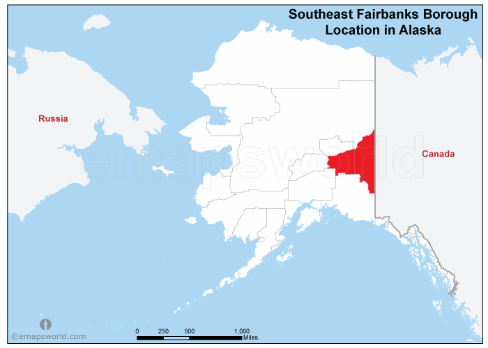
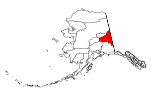
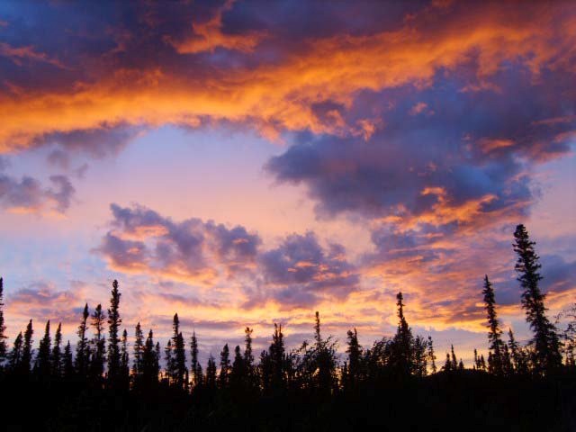
Fairbanks North Star Borough
& SE Fairbanks Census Area

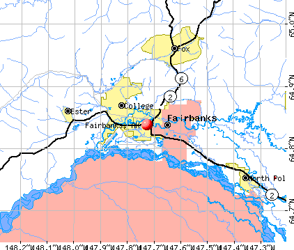
Ester to North Pole
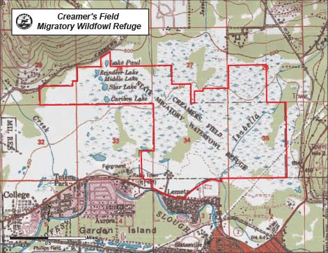
Creamer's Field
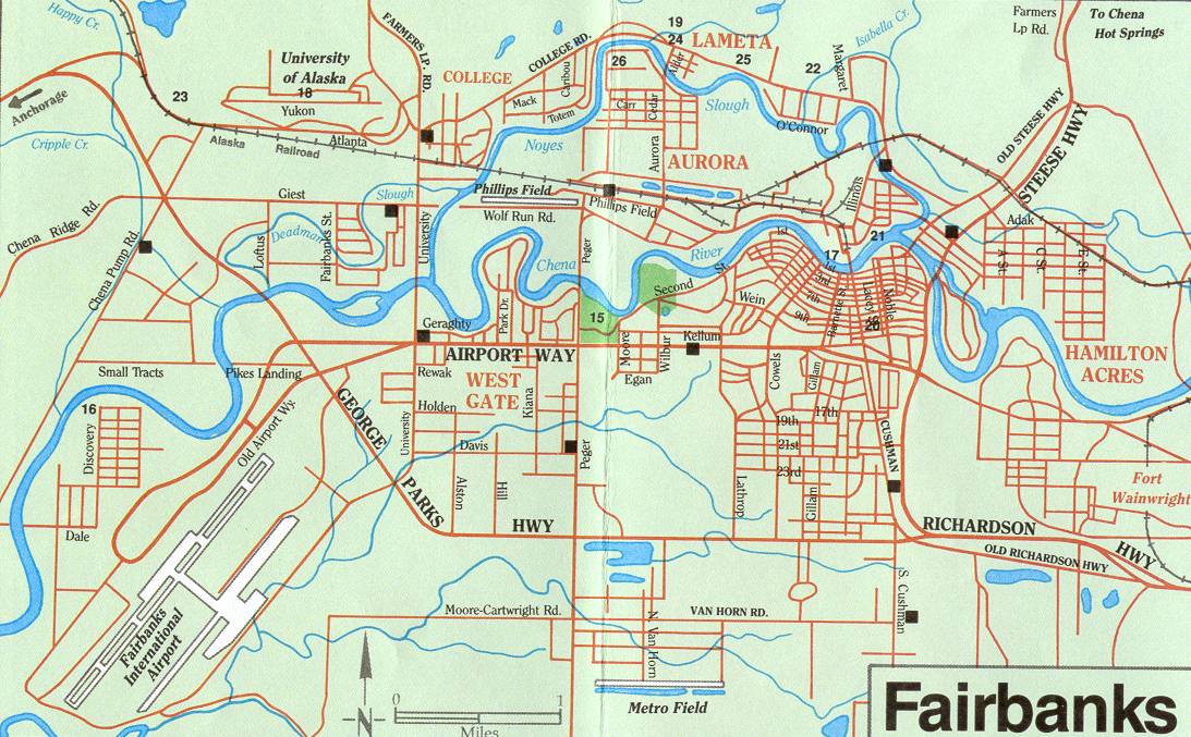
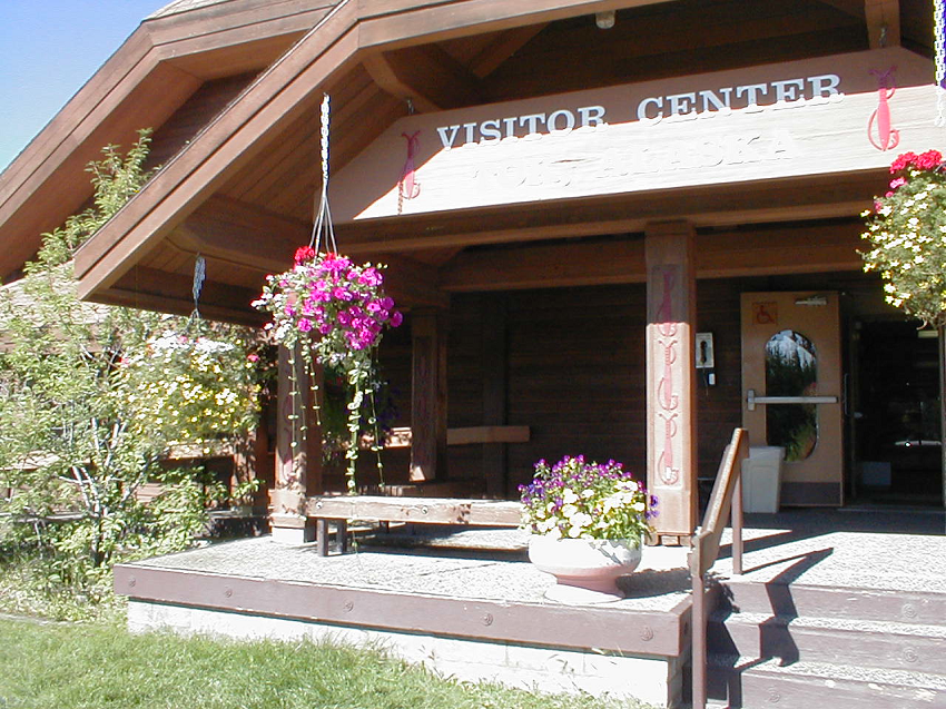
Fairbanks
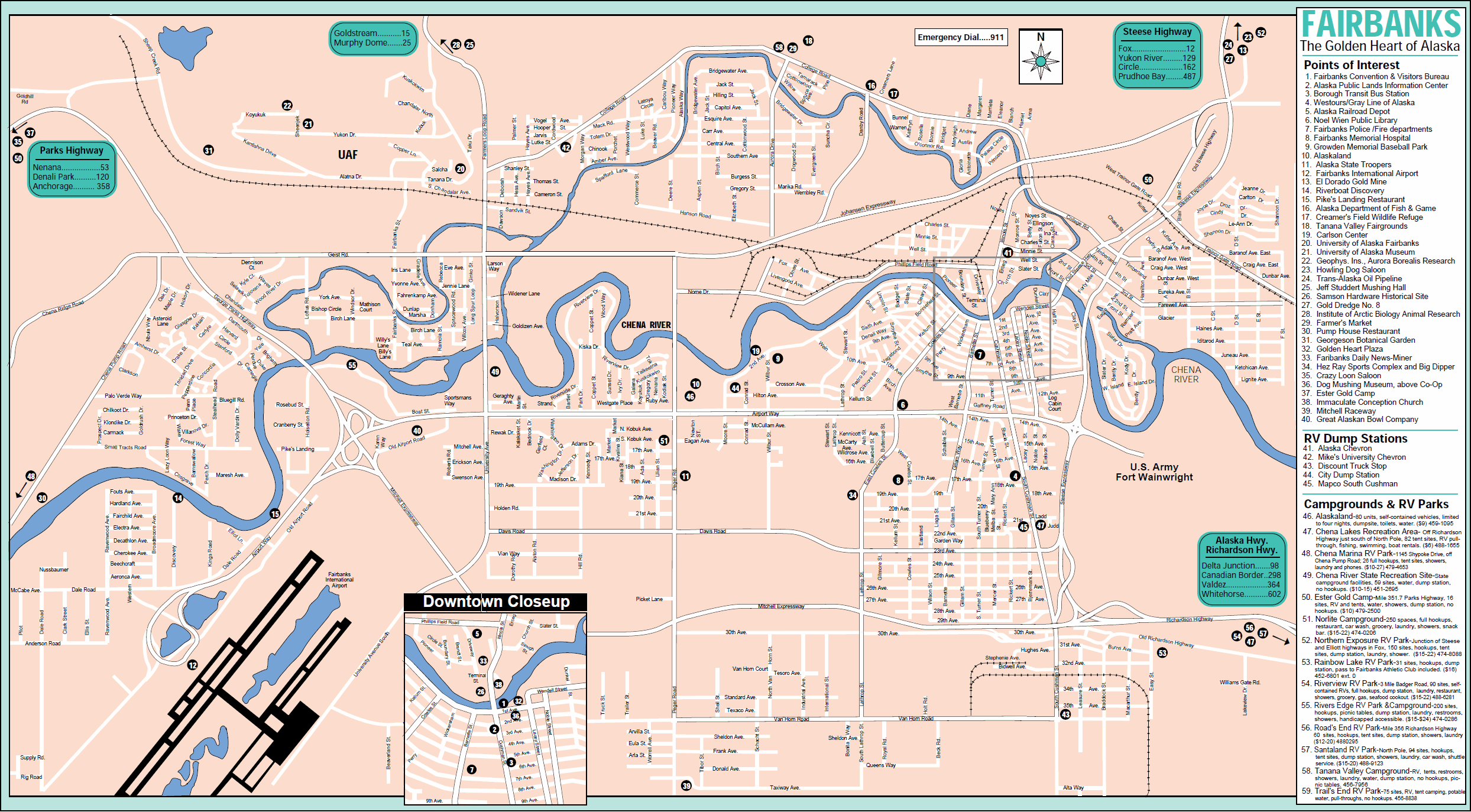
Fairbanks
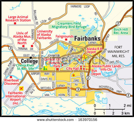
Fairbanks
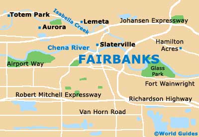
Fairbanks
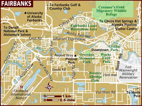
Fairbanks
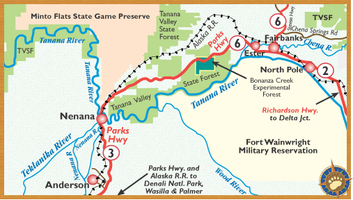
Anderson to North Pole
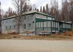
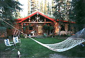
 Aurora Lodge
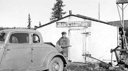
Established in 1902 when the U.S. Army Signal Corps located the Salcha telegraph station about three miles from the mouth of the Salcha River. The Salchaket post office (from the Indian name "Salchakaket" i.e. "mouth of the Salcha") was located at the mouth of the Salcha in 1909; discontinued in 1926 (Ricks, 1965, p. 55). The trading post and roadhouse are shown on maps as "Munsons" and recently "Aurora." Located along the Richardson Highway at junction of Salcha and Tanana Rivers, 40 mi. NW of Big Delta, Tanana Low.
Named by personnel of The Alaska Railroad in 1949, "so called because it is in the vicinity of the Old Badger Road." Located in Fairbanks North Star Borough.
Suburb south of Fairbanks at north terminus of Richardson Highway
On Richardson Highway, 19 miles southeast of Fairbanks, Tanana Low. Local name derived from nearby Moose Creek Bluff.
Residential suburb, 5 mi. SW of Fairbanks, on S bank of Chena River adjacent to Fairbanks International Airport, Tanana Low. Local name was published in 1955 by U.S. Geological Survey, also called South Bjerremark because it was part of the Bjerremark Homestead before it was subdivided.
Mining settlement established about 1904, and railroad station when the Tanana Valley Railroad was completed in 1907. The Chatanika post office was established in 1908. Its population was 63 in 1930 and 106 in 1940. It was named after the stream. Population 30, 2 mi. E of junction of Cleary Creek and Chatanika River, 20 mi. NE of Fairbanks, Yukon-Tanana High. Located in the Fairbanks North Star Borough.
Name derived from the Chena River and reported in 1903 by T. G. Gerdine and R. B. Olive (in Prindle, 1905, pl. 16). The village was called "Chena Junction" because it was the south terminus of the Tanana Valley Railroad; however, it was incorporated as "Chena" in 1903. A post office was established in 1903 and discontinued in 1918 (Ricks, 1965, p. 10). With the growth of Fairbanks, Chena disappeared and had only 18 persons in 1920. Description: on N bank of Tanana River, 1 mi. W of mouth of Chena River and 7 mi. SW of Fairbanks, Tanana Low.
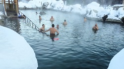
Local name derived from the Chena River near headwaters of which the hot springs are located. The springs were reported in 1907 by C. C. Covert, U.S. Geological Survey (USGS), and the name was reported in 1912 by Ellsworth and Davenport (1915, p. 59), U.S. Geological Survey (USGS). Located in the Fairbanks North Star Borough, it is about 60 miles west of Fairbanks.
Local name derived from Clear Creek and published in 1955 by U.S. Geological Survey (USGS). Description: on right bank of Clear Creek, 5 mi. SE of Fairbanks, Tanana Low.
"College was so named, because it is the location of the University of Alaska at Fairbanks, established in 1915. College is a large suburban area of the Fairbanks North Star Borough. Many residents are employed by or attend the nearby University of Alaska at Fairbanks." [*CRA] Located in the Fairbanks North Star Borough.
Local name reported in 1950 by U.S. Geological Survey (USGS) topographers. 5.5 mi. E of Fairbanks, on S bank of Chena River; Tanana Low.
Name reported in 1954 by U.S. Geological Survey (USGS). 3 mi. N of College and 5 mi. NW of Fairbanks, Yukon-Tanana High
Name of a former mining camp. The settlement began about 1905 (Kitchener, 1954, p. 297); a post office, established here in 1906, was transferred to Olnes in 1922 (Ricks, 1965, p. 17). Name published in 1907 by U.S. Geological Survey (USGS). On left bank of Dome Creek, 14 mi. N of Fairbanks, Yukon-Tanana High.
This is a military base. "Most Air Force members and their families actually live on the base. Some have chosen to live in nearby North Pole. The base is self-contained and is essentially non-Native. " [*CRA] Located in the Fairbanks North Star Borough.
E of headwaters of Little Eldorado Creek, 12 mi. N of Fairbanks, Yukon-Tanana High.
Name of a mining camp whose name was derived from Engineer Creek. A post office was established here in 1909 and discontinued in 1911. (Ricks, 1965, p. 19). The camp is now only an abandoned site. On Engineer Creek, 9 mi. NE of Fairbanks, Yukon-Tanana High. sec 2, T1N, R1W, Fairbanks Meridian.
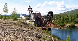
"Ester began in 1904 as a gold mining camp at the Discovery Claim on
Ester Creek, one of the richest creeks in the Fairbanks Gold Rush. By 1907
'Ester City' had a population of several hundred, with hotels, saloons,
stores and a social hall. After 1910 the town's population began a slow
decline. Mining, and with it the town, revived in the 1930s when the
Fairbanks Exploration Company (FE) bought up the old claims on Ester Creek
and nearby Cripple Creek. Starting in 1933 the FE built a mess hall, bunk
houses, offices, shops and warehouses at Ester, uphill from the old town.
They ran two gold dredges out of the Ester Gold Camp, one of which mined
through the entire original Ester townsite. In 1958 the FE sold the Ester
Gold Camp to local investors who reopened it as the Cripple Creek Resort.
The Ester Gold Camp, now recognized as a National Historic District, closed
after the 2007 season. It is now for sale. While gold mining continues in
the area, Ester today is largely a bedroom community for nearby Fairbanks
and the University of Alaska. It is known for artists and artistry of all
kinds, for the quirky behavior of its citizens, and for its sense of humor.
Ester's zany annual Fourth of July parade has been described as 'a cross
between Norman Rockwell and the Twilight Zone.' " [*CRA] Located in the
Fairbanks North Star Borough.
The Berry post office was located here for
a while; name changed to Ester post office in 1965.
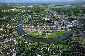 "Koyukon
Athabascans have lived in this area for thousands of years. In 1901, Captain
E.T. Barnette established a trading post on the Chena River called
'Barnette's Cache.' A year later, gold was discovered 16 miles north of the
post. The town grew as the Chena steamboat landing brought many prospectors
during the Pedro Dome gold rush. Fairbanks was named in 1902 after Indiana
Senator Charles Fairbanks, who became Vice President of the US from 1905 to
1909. In 1903, Judge Wikersham moved the seat of the third judicial district
from Eagle to Fairbanks. The population of the area continued to increase as
Fairbanks became the hub of the Interior with the addition of the court,
government offices, a jail, a post office, and the Northern Commercial
Company. Barnette was elected as the first mayor of the City of Fairbanks in
1903 and established telephone service, fire protection, sanitation
ordinances, electricity, and steam heat. He also founded the
Washington-Alaska Bank. By 1910, the official population had grown to 3,541,
although more than 6,000 miners lived and worked their claims on creeks
north of town. Ladd Field (now Fort Wainwright) was constructed in 1938.
Construction of the Alcan Highway in the 1940s and the Trans-Alaska oil
pipeline in the 1970s fueled growth and development. Culture The Fairbanks
area is the second-largest population settlement in Alaska." [*CRA] Located
in the Fairbanks North Star Borough.
"Koyukon
Athabascans have lived in this area for thousands of years. In 1901, Captain
E.T. Barnette established a trading post on the Chena River called
'Barnette's Cache.' A year later, gold was discovered 16 miles north of the
post. The town grew as the Chena steamboat landing brought many prospectors
during the Pedro Dome gold rush. Fairbanks was named in 1902 after Indiana
Senator Charles Fairbanks, who became Vice President of the US from 1905 to
1909. In 1903, Judge Wikersham moved the seat of the third judicial district
from Eagle to Fairbanks. The population of the area continued to increase as
Fairbanks became the hub of the Interior with the addition of the court,
government offices, a jail, a post office, and the Northern Commercial
Company. Barnette was elected as the first mayor of the City of Fairbanks in
1903 and established telephone service, fire protection, sanitation
ordinances, electricity, and steam heat. He also founded the
Washington-Alaska Bank. By 1910, the official population had grown to 3,541,
although more than 6,000 miners lived and worked their claims on creeks
north of town. Ladd Field (now Fort Wainwright) was constructed in 1938.
Construction of the Alcan Highway in the 1940s and the Trans-Alaska oil
pipeline in the 1970s fueled growth and development. Culture The Fairbanks
area is the second-largest population settlement in Alaska." [*CRA] Located
in the Fairbanks North Star Borough.
 Faith Creek (historical)
Name of a former roadhouse and small settlement; published in 1916 (polk's Gazetteer, 1916). On left bank of Chatanika River, opposite mouth of Faith Cree, 76 mi. SW of Circle, Yukon-Tanana High.
Community in Fairbanks North Star Borough.
This mining camp was named for Tom Gilmore, Felix Pedro's partner, and was first shown on a manuscript map by C. W. Joint in 1905. The camp is now abandoned. It was located on right bank of Pedro Creek, 11 mi. NE of Fairbanks, Yukon-Tanana High. sec 22, T2N, R1E, Fairbanks Meridian.
Name applied by prospectors to a former mining camp; reported in 1903 by T. G. Gerdine, (Prindle, 1905, pl. 13), U.S. Geological Survey (USGS). Located at junction of Twin and Pedro Creeks, 14 mi. NE of Fairbanks, Yukon-Tanana High.
"Local name reported in 1903 by T.G. Gerdine. The Valley of this stream, one of the earliest gold miing areas in the Fairbanks region, was settled by 1905. (Kitchener, 1954, p. 297)" [*CRA] Located in the Fairbanks North Star Borough.
Originally a townsite listed in 1916 Polk's Gazetteer; the village has been annexed by the city of Fairbanks, on N bank of Chena River, E of Garden I., Tanana Low.
"The lake was originally reported by the U.S. Geological Survey in 1909 as 'Salchaket Lake.' The lake was later named for Warren Harding, the 29th President of the U.S., who visited Alaska just before his death. Harding Lake is a summer recreation site for Fairbanks residents. There are a large number of recreatonal-use homes in the area and only a few residents remain year-round." [*CRA] Located in the Fairbanks North Star Borough.
Local name reported in 1950 by U.S. Geological Survey (USGS) topographers. 12 mi. SE of Fairbanks, on S side of Richardson Highway, N of North Pole, Tanana Low
Local name reported in 1950 by U.S. Geological Survey (USGS) topographers. Population 1,015, residential suburb 1 mi. N of Fairbanks, Tanana Low
Name published in 1907 by U.S. Geological Survey (USGS) as Mehan, an abandoned gold dredging camp. The settlement began about 1905 (Kitchner, 1954, p. 297) and was named by prospectors for an early miner, Pat Meehan. A post office was established here in 1906 and maintained until 1942 (Ricks, 1965, p. 41). Located 4.3 km (3 mi) NW of Fairbanks Camp Creek, 0.8 km (0.5 mi) W of Alder Creek Camp on the N bank of Fairbanks Creek between Crane Creek and Alder Creek, 35.4 km (22 mi) NE of Fairbanks, Yukon-Tanana High.
"The area is a result of the growth of Eielson Air Force Base and North Pole. Moose Creek is a suburb of the greater Fairbanks area and is better characterized as a geographic location rather than a community. Most residents are non-Native." [*CRA] Located in the Fairbanks North Star Borough.
"In 1944, Bon Davis homesteaded this area. Dahl and Gaske Development Company later bought the Davis homestead, subdivided it, and named it North Pole, hoping to attract a toy manufacturer that would advertise products as being made in North Pole. The Santa Claus House was subsequently developed by Con Miller and his family. The city was incorporated in 1953. Growth from Fairbanks and the nearby Eielson Air Force Base have increased development over the years. Culture North Pole is renowned as the 'home of Santa Claus.' Letters from children all over the world are mailed to North Pole at Christmas each year. The Santa Claus House is a year-round attraction." [*CRA] Located in the Fairbanks North Star Borough.
Mining supply village and former RR. station on the Tanana Valley RR., reported in 1907 by U.S. Geological Survey (USGS). The Olness post office was established in 1908, discontinued in 1910, and then reestablished as "Olnes" in 1922; finally discontinued in 1925. According to U.S. Geological Survey (USGS) it was named for a miner who spelled his name "Olnes" (complete name not available). Location: 16 mi. N of Fairbanks, Yukon-Tanana High.
Local name of a mining camp reported to have existed by 1905 (Kitchener, 1954, p. 297). The name was derived from Pedro Creek, which in turn was named for Felix Pedro who discovered gold in the valley. On right bank of Pedro Creek, 12 mi. NE of Fairbanks, Yukon-Tanana High.
"The area is a recent development that has occurred as a result of population growth in the greater Fairbanks area. Pleasant Valley is best characterized as a geographic location, rather than a community. Most residents are non-Native." [*CRA] Located in the Fairbanks North Star Borough.
Former village and post office established in 1906 and named for Major Wilds P. Richardson, USA, first President of the Board of the Alaska Road Commission (ARC), who "established a sled road between Valdez on the coast, and Fairbanks, the largest settlement in the interior, a distance of 370 miles." (Brooks, 1953, p . 425-26). Eventually, the Tanana River changed its course and the erosive effects forced the people to move. The post office was discontinued in 1943 (Ricks, 1965, p. 54). Location: on right bank of Tanana River, 18 mi. NW of Big Delta, Tanana Low.
"The village was first reported in 1898 by the U.S. Geological Survey as 'Salchaket,' an Indian name meaning 'mouth of the Salcha.' The village was reported in 1904 as 'Saltshatsheg.' Salcha includes many occasional-use homes for Fairbanks residents. There are a number of competitive dog mushers in the community." [*CRA] Located in the Fairbanks North Star Borough.
Local name reported in 1950 by U.S. Geological Survey (USGS) topographers. Population 611 (1950), residential suburb on Garden I., N of Fairbanks, Tanana Low
Located in S section of Fairbanks; Tanana Low.
A community east of the Fairbanks International Airport
Local name derived from Standard Creek, listed in a timetable in 1922. Location: on The Alaska RR. 25 mi. SW of Fairbanks, Yukon-Tanana High.
Steele Creek is located northeast of Fairbanks and east of the Steese Highway. The community is named for the creek which flows from north to south across the western part of the CDP (census-designated place), rising on Tungsten Hill and flowing towards the Chena River. The CDP extends east as far as the Little Chena River and Iowa Creek. The CDP is bounded by Two Rivers to the east, Badger to the south, Fairbanks to the southwest, Farmers Loop to the west, and Fox to the northwest.
"The community lies on the banks of the upper Chena River, near the Little Chena River. It was the site of a territorial school. Expansion of the greater Fairbanks area since the 1970s has enabled the community to expand and develop. Dog mushing is a prevalent activity in Two Rivers. There are several community organizations, including churches, the PTA, the Ski Club, 4-H, and scouts. A recreational complex is available at Pleasant Valley, which supports baseball, basketball, tennis, ice skating, and hockey." [*CRA] Located in the Fairbanks North Star Borough, between mile 13 (the Little Chena River) and mile 25 (the Chena River) on the Chena Hot Springs Road.
Name of a former mining camp published in 1907 by U.S. Geological Survey (USGS). A post office was established here in 1908 and discontinued in 1909 (Ricks, 1965, p. 69). Located on right bank of Vault Creek, 0.5 mi. E of Treasure Creek and 12 mi. N of Fairbanks, Yukon-Tanana High.
Name probably derived from its being at the west end of the city adjacent to the airport. Subdivision now within corporate limits of city of Fairbanks, on S bank of Chena River, Tanana Low.
*CRA Extracted from State of Alaska, Department of Commerce, Community, and Economic Development's, Community and Regional Affairs website.
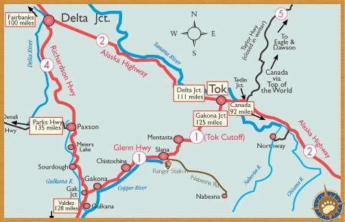
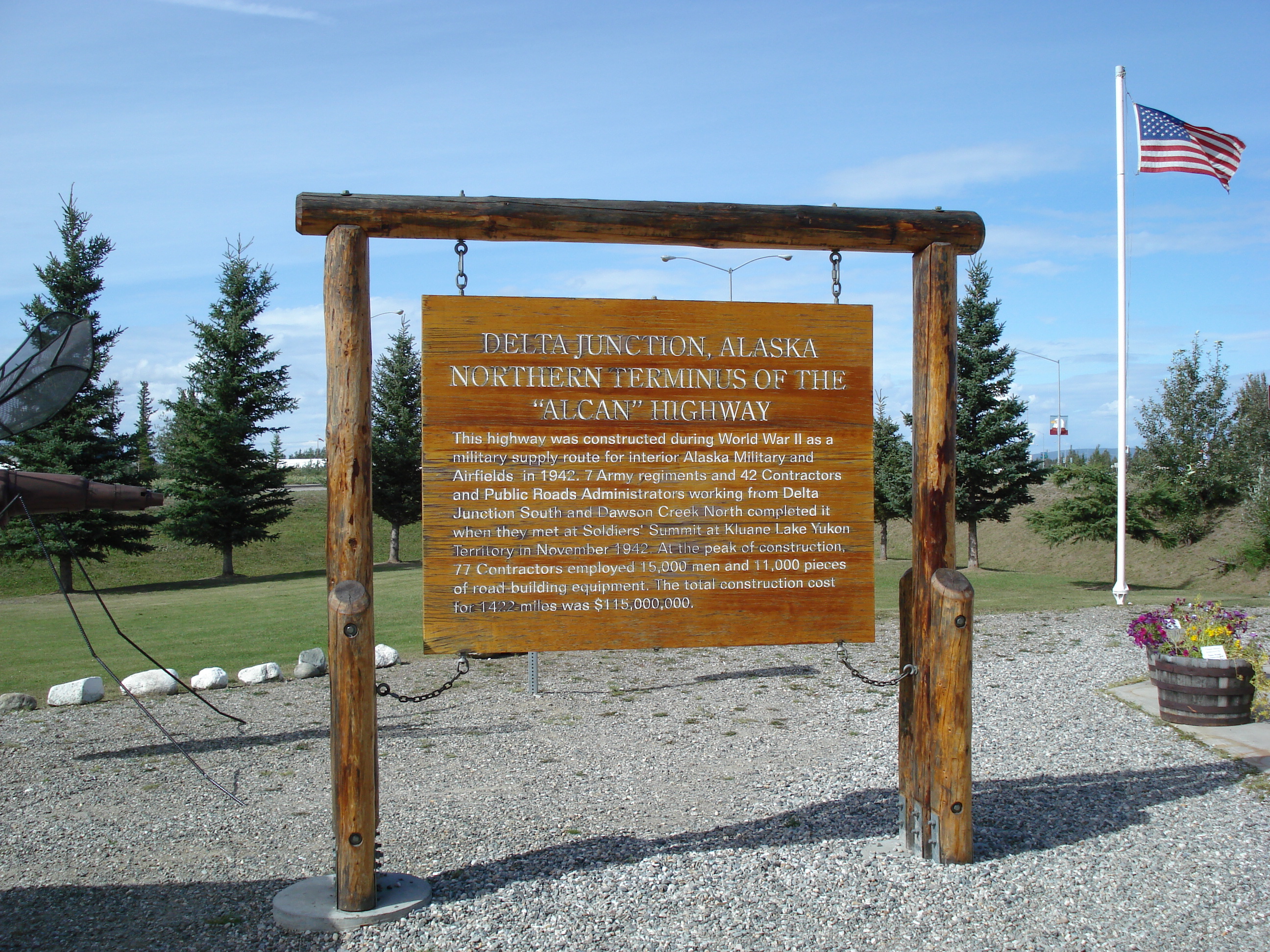
Delta Junction to Tok
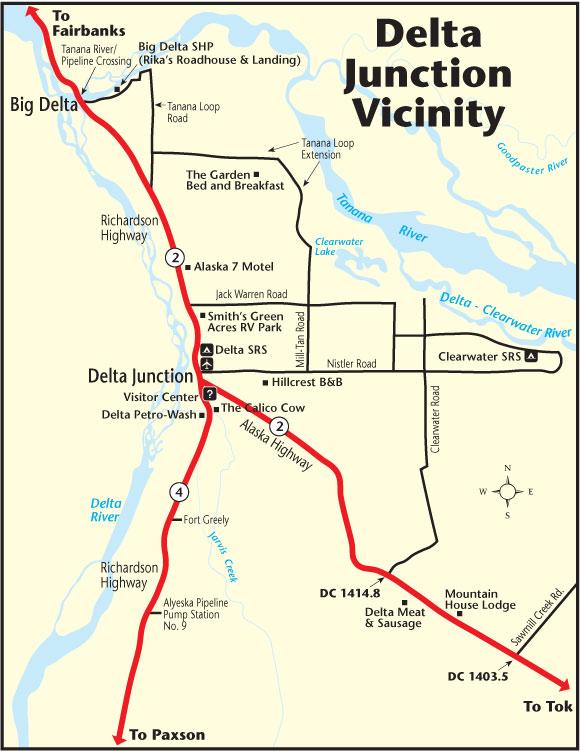
Delta Junction
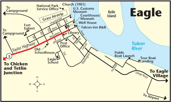
Eagle
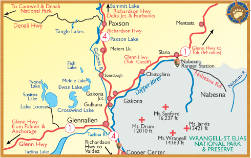
Nabesna
"The community lies on the banks of the upper Chena River, near the Little Chena River. It was the site of a territorial school. Expansion of the greater Fairbanks area since the 1970s has enabled the community to expand and develop. Dog mushing is a prevalent activity in Two Rivers. There are several community organizations, including churches, the PTA, the Ski Club, 4-H, and scouts. A recreational complex is available at Pleasant Valley, which supports baseball, basketball, tennis, ice skating, and hockey." [*CRA] The name is derived from the Alaska-Canadian (Alcan) Highway. It is located in the Southeast Fairbanks Census Area.
Village established in 1904 by the U.S. Army Signal Corps as the Mccarthy (or Mccarty) Telegraph Station. The Washburn post office was established here, or near here, and operated from 1905 to 1913. The Big Delta post office operated from 1925 to 1959, from which the village received its present name. Its population was 155 in 1950. Located at the junction of Delta and Tanana Rivers, 73 miles southwest of Fairbanks, in the Southeast Fairbanks Census Area.
"Oral history and a substantial inventory of Native place names suggest that Tanana Athabascans occupied the site throughout most of the 19th and early 20th centuries. The Big Delta Natives began leaving their ancestral homeland shortly after the peak of the Alaska gold rush between 1898 and 1903. In 1899 the U.S. Army sent parties to investigate the Susitna, Matanuska, and Copper River Valleys to find the best route for a trail north from Valdez, through the Copper River Valley. By 1901 the army had completed the Trans-Alaska Military Road, which extended from Valdez to Eagle City. In 1902 gold was discovered in the Tanana Valley, and, shortly after, a spur trail was created from Gulkana on the Valdez-Eagle route to the new mining camp in Fairbanks. This trail became the Valdez-Fairbanks Trail. During 1903, Lt. Billy Mitchell of the U.S. Army Signal Corps supervised the construction of a telegraph line from Eagle to the mouth of the Goodpaster River. The Goodpaster telegraph station was part of the Washington/Alaska Military Cable and Telegraph System (WAMCATS). During the winter of 1904-05, the Goodpaster Station was destroyed by fire and relocated to Big Delta. In April 1904, a prospector named Ben Bennett staked out 80 acres and built a trading post at Big Delta on the left bank of the Tanana River. In April 1905, Bennett sold his trading post to Daniel G. McCarty. Although Bennett owned the trading post and surrounding acreage, he was grubstaked for all of the merchandise by his partner, E.T. Barnette, the wealthy founder of the City of Fairbanks. Thus, when Bennett decided to sell out to McCarty, all of the goods at the trading post still belonged to Barnette. However, in the early 1900s, the trading post and roadhouse built by Bennett became commonly known as McCarty's or McCarty Station. Another prospector named Alonzo Maxey, along with a friend, set up Bradley's Roadhouse in the hope of diverting travelers from McCarty's." [*CRA]
"Boundary was a placer mining camp with a post office established in 1940 and discontinued in 1956. It was so called because of its nearness (three miles) to the Alaska-Canada boundary. Boundary is situated on an unpaved portion of the Alaska Highway, just east of Jack Wade Junction, on the Alaskan side of the Canadian border. It is a small community with just a few rustic buildings, including the Boundary Lodge." [*CRA]
"Former Indian village of which Lieutenant Schwatka (1885b, p. 41 and 42), USA, wrote, on the 23d of July (1883) we reached another Indian village, called Charley's Village, which is the exact counterpart of the one called Johnny's, even to the number of houses (6) *** We met a Canadian voyageur among them who calls them and Johnny's village the Tadoosh Indians, and says they are the most friendly and best natured Indians on this part of the river. Archdeacon Stuck (1917, p. 82) stated that the village was named for a 'Chief Charley.' The village stood until the high water of the 1914 ice breakup when it was washed away, and the natives moved to Circle." Dictionary of Alaska Place Names by Donald J Orth. Located on the right bank of Yukon River at the mouth of Kandik River, Porcupine Plateau.
Local name reported by U.S. Geological Survey (USGS) in 1954. Located on Charlieskin Creek, 5.5 mi. S of Northway Junction, Alaska Range
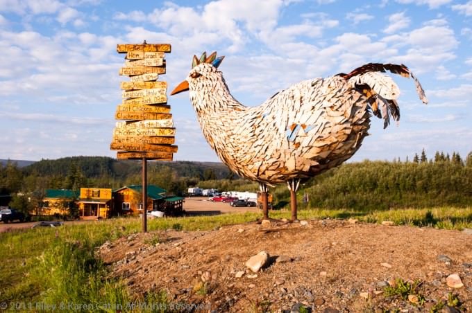
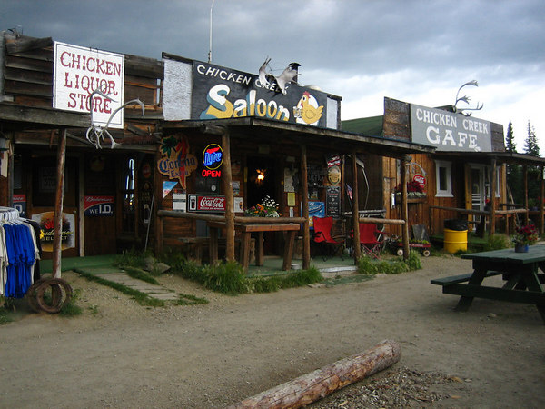
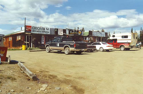
Mining camp and post office established in 1903. Was a common name for the ptarmigan in 1930. Located on right bank of Chicken Creek 1 mi. N of Mosquito Fork, 58 mi. SW of Eagle.
 "Tanana
Athabascan Indians occupied this site throughout most of the 19th
and early 20th centuries. The peak of the Alaska gold rush was between 1898
and 1903. In 1899, the army sent parties to investigate the Susitna,
Matanuska, and Copper River valleys to find the best route for a trail north
from Valdez through the Copper River Valley. By 1901, the army had completed
the Trans-Alaska Military Road, which extended from Valdez to Eagle. In
1902, gold was discovered in the Tanana Valley, and, shortly after, a spur
trail was created from Gulkana on the Valdez-Eagle route to the new mining
camp in Fairbanks. This trail became the Valdez-Fairbanks Trail. The
Sullivan Roadhouse was built in 1905 by John and Florence Sullivan on a part
of the Valdez-Fairbanks Trail known as the Donnelly-Washburn Cut-Off. This
section of the trail was considered by many to be too steep, so the Alaska
Road Commission built a new road which was four miles from the Sullivan
Roadhouse.
"Tanana
Athabascan Indians occupied this site throughout most of the 19th
and early 20th centuries. The peak of the Alaska gold rush was between 1898
and 1903. In 1899, the army sent parties to investigate the Susitna,
Matanuska, and Copper River valleys to find the best route for a trail north
from Valdez through the Copper River Valley. By 1901, the army had completed
the Trans-Alaska Military Road, which extended from Valdez to Eagle. In
1902, gold was discovered in the Tanana Valley, and, shortly after, a spur
trail was created from Gulkana on the Valdez-Eagle route to the new mining
camp in Fairbanks. This trail became the Valdez-Fairbanks Trail. The
Sullivan Roadhouse was built in 1905 by John and Florence Sullivan on a part
of the Valdez-Fairbanks Trail known as the Donnelly-Washburn Cut-Off. This
section of the trail was considered by many to be too steep, so the Alaska
Road Commission built a new road which was four miles from the Sullivan
Roadhouse.
 The
Sullivans tore the roadhouse apart and rebuilt it alongside
the new road. Ongoing mining activity just north of Delta Junction in the
Tenderfoot area and the Chisana Gold Strike of 1913 brought many prospectors
and other travelers through the area. The Delta Junction area became known
as Buffalo Center for the American bison that were transplanted here from
the National Bison Range in Montana in the 1928. In 1942, construction of
the Alaska Highway began, and Fort Greely military base was completed 5
miles to the south. In 1946, a dairy farm was established; beef cattle were
brought in during 1953 by homesteaders. Delta Junction was incorporated as a
second-class city in 1960. Construction of the Trans-Alaska Pipeline between
1974 and 1977 brought a dramatic upswing to the population and economy. In
August 1978, the state initiated Delta Agricultural Project I, a 60,000-acre
demonstration agricultural project. Twenty-two parcels, averaging 2,700
acres in size were sold by lottery." [*CRA]
The
Sullivans tore the roadhouse apart and rebuilt it alongside
the new road. Ongoing mining activity just north of Delta Junction in the
Tenderfoot area and the Chisana Gold Strike of 1913 brought many prospectors
and other travelers through the area. The Delta Junction area became known
as Buffalo Center for the American bison that were transplanted here from
the National Bison Range in Montana in the 1928. In 1942, construction of
the Alaska Highway began, and Fort Greely military base was completed 5
miles to the south. In 1946, a dairy farm was established; beef cattle were
brought in during 1953 by homesteaders. Delta Junction was incorporated as a
second-class city in 1960. Construction of the Trans-Alaska Pipeline between
1974 and 1977 brought a dramatic upswing to the population and economy. In
August 1978, the state initiated Delta Agricultural Project I, a 60,000-acre
demonstration agricultural project. Twenty-two parcels, averaging 2,700
acres in size were sold by lottery." [*CRA]
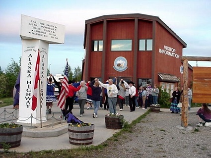
 "Delta
Junction is strategically located to provide services to summer
tourist traffic. The visitor's center is located in the 'Triangle,' where
the Alaska Highway meets the Richardson Highway. The community also has an
elementary school, middle school, high school (with track and football
field), career advancement center, outdoor skating rink, unheated skating
facility, city park with ball fields, and some bike paths." [*CRA]
"Delta
Junction is strategically located to provide services to summer
tourist traffic. The visitor's center is located in the 'Triangle,' where
the Alaska Highway meets the Richardson Highway. The community also has an
elementary school, middle school, high school (with track and football
field), career advancement center, outdoor skating rink, unheated skating
facility, city park with ball fields, and some bike paths." [*CRA]
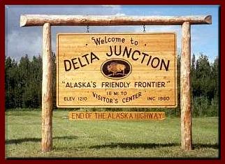
Located in the Southeast Fairbanks Census Area. Established as a road construction camp about 1919, but has developed into a fairly large village in recent years primarily because of its strategic locality at the junction of two major highways. It was originally called "Buffalo Center" because it is near the site of the winter range for a herd of American bison established in 1927. On the E side of the Delta River, 9 mi SSE of its confluence with the Tanana River at Big Delta, Alaska Range.
Mining camp, now abandoned, reported in 1903 by Prindle (1905, p. 10), U.S. Geological Survey (USGS). Located on N bank of Dome Creek at mouth of Georgie Creek, 29 mi. S of Eagle, Yukon-Tanana High.
Established as a telegraph station about 1904 by the U.S. Army Signal Corps, and a stage station on the Fairbanks-Chitina trail. On Richardson Highway, 26 mi. S of Delta Junction, Alaska Range
 "Archaeological
evidence at nearby Healy Lake revealed more than 10,000
years of human habitation. Dot Lake was used as a seasonal hunting camp for
Athabascans from George Lake and Tanacross. A Native freight trail ran north
to the Yukon River through Northway, Tetlin, Tanacross, and Dot Lake. During
construction of the Alaska Highway in 1942-43, a work camp called Sears City
occupied Dot Lake's present location. Several local Natives worked on the
road project. Fred and Jackie Vogle were the first non-Native settlers in
the area. They received a home site and by 1949 had constructed a lodge,
post office, school, and the Dot Lake Community Chapel." [*CRA] Located in
the Southeast Fairbanks Census Area.
"Archaeological
evidence at nearby Healy Lake revealed more than 10,000
years of human habitation. Dot Lake was used as a seasonal hunting camp for
Athabascans from George Lake and Tanacross. A Native freight trail ran north
to the Yukon River through Northway, Tetlin, Tanacross, and Dot Lake. During
construction of the Alaska Highway in 1942-43, a work camp called Sears City
occupied Dot Lake's present location. Several local Natives worked on the
road project. Fred and Jackie Vogle were the first non-Native settlers in
the area. They received a home site and by 1949 had constructed a lodge,
post office, school, and the Dot Lake Community Chapel." [*CRA] Located in
the Southeast Fairbanks Census Area.
 "The
Native village was settled by Doris Charles and her family in 1946.
Between 1946 and 1950, other families moved permanently to Dot Lake from
George Lake, Sam Lake, and the Tanacross area, obtaining homesites or Native
allotments. Some of the old work camp structures were converted into homes.
In 1971, seven new homes were constructed along the lake. The Dot Lake
Native Corporation developed a shareholder's subdivision, consisting of 53
one-acre lots. In 1994 and 1996, nine additional Indian Housing Authority
homes were built. The Native Village of Dot Lake is a traditional Upper
Tanana Athabascan village located two-tenths of a mile southeast of the
highway." [*CRA] Located in the Southeast Fairbanks Census Area.
"The
Native village was settled by Doris Charles and her family in 1946.
Between 1946 and 1950, other families moved permanently to Dot Lake from
George Lake, Sam Lake, and the Tanacross area, obtaining homesites or Native
allotments. Some of the old work camp structures were converted into homes.
In 1971, seven new homes were constructed along the lake. The Dot Lake
Native Corporation developed a shareholder's subdivision, consisting of 53
one-acre lots. In 1994 and 1996, nine additional Indian Housing Authority
homes were built. The Native Village of Dot Lake is a traditional Upper
Tanana Athabascan village located two-tenths of a mile southeast of the
highway." [*CRA] Located in the Southeast Fairbanks Census Area.
 "The
area was originally settled by highway construction and maintenance
crews and their families. Members of the Living Word Ministry community
reside on privately-owned land acquired as Open to Entry parcels between
1971 and 1973. Many of the current residents are members of the Living Word
Ministry, Inc., a non-denominational Christian community. Living Word
Ministry was established in 1973." [*CRA] Located in the Southeast Fairbanks
Census Area.
"The
area was originally settled by highway construction and maintenance
crews and their families. Members of the Living Word Ministry community
reside on privately-owned land acquired as Open to Entry parcels between
1971 and 1973. Many of the current residents are members of the Living Word
Ministry, Inc., a non-denominational Christian community. Living Word
Ministry was established in 1973." [*CRA] Located in the Southeast Fairbanks
Census Area.
 "The
area has been the historical home to Han Kutchin Indians. Established
as a log house trading station called 'Belle Isle' around 1874, it operated
intermittently as a supply and trading center for miners working the upper
Yukon and its tributaries. Eagle City was founded in 1897 and was named
after the nesting eagles on nearby Eagle Bluff. By 1898, the population had
grown to over 1,700. A U.S. Army camp was established in 1899, and Fort
Egbert was completed in 1900. Eagle became the first incorporated city in
the Interior in January 1901. The Valdez-Eagle Telegraph line was completed
in 1903. By 1910, Fairbanks and Nome gold prospects had lured away many, and
the population had declined to 178. Fort Egbert was abandoned in 1911."
[*CRA] Located in the Southeast Fairbanks Census Area.
"The
area has been the historical home to Han Kutchin Indians. Established
as a log house trading station called 'Belle Isle' around 1874, it operated
intermittently as a supply and trading center for miners working the upper
Yukon and its tributaries. Eagle City was founded in 1897 and was named
after the nesting eagles on nearby Eagle Bluff. By 1898, the population had
grown to over 1,700. A U.S. Army camp was established in 1899, and Fort
Egbert was completed in 1900. Eagle became the first incorporated city in
the Interior in January 1901. The Valdez-Eagle Telegraph line was completed
in 1903. By 1910, Fairbanks and Nome gold prospects had lured away many, and
the population had declined to 178. Fort Egbert was abandoned in 1911."
[*CRA] Located in the Southeast Fairbanks Census Area.
 Eagle Village
The area has been the historical home to Han Kutchin Indians. The Han Kutchin Indian village associated with nearby Eagle was the original site of this Indian village before the mining camp was established there. The early village was called 'Johnnys' by 'the whites' because its chief was known as 'John.' On left bank of Yukon River, 3 mi. E of Eagle, Yukon-Tanana High.
Mining camp reported in 1925 by Alaska Road Commission (ARC). Located on S bank of Seventymile River at mouth of Flume Creek, 40 mi. NW of Eagle, Yukon-Tganana High.
"The local name was reported in 1914 by the U.S. Geological Survey. Due to declining enrollment, the school closed in 1999. Healy Lake is a mixed Athabascan and non-Native community." [*CRA] Located in the Southeast Fairbanks Census Area.
Roadhouse and settlement reported in 1914 by C. E. Giffin (in Capps, 1916, pl. 2), U.S. Geological Survey (USGS). Located on left bank of Beaver Creek, 10 mi. N of Ptarmigan Lake and 70 mi. NE of McCarthy; Alaska Range
Mining camp named by miners for Jack Wade, prospector; reported in 1903 by T. G. Gerdine (in Prindle, 1905, pl. 16), U.S. Geological Survey (USGS). post office was established in 1901 and maintained until 1948 (Ricks, 1965, p. 29). 1940. On Wade Creek, 46 mi. S of Eagle; Yukon-Tanana High.
Indian name reported by U.S. Geological Survey (USGS) in 1955. On NE shore of Fish Lake, 3 mi. E of Northway, Alaska Range.
Named for the lake. Population 39. S of Lake Mansfield, 6 mi. NW of Tanacross, Yukon-Tanana High.
Nabesna Indian village reported by U.S. Geological Survey (USGS) in 1945. This may represent the same people that once occupied a village called "Khiltats" at the mouth of the Nabesna River (Hodge, 1907, p. 679). On W bank of Nobesna River 6 mi. SW of Northway Junction, Alaska Range.
 "The
area around Northway was first
utilized by semi-nomadic Athabascans who pursued seasonal subsistence
activities in the vicinity of Scottie and Gardiner Creeks and Chisana,
Nabesna, and Tanana Rivers. The Native settlement of Northway Village is
located 2 miles south of Northway. The Native village was named in 1942
after Chief Walter Northway, who adopted his name from a Tanana and Nabesna
riverboat captain. The development and settlement of Northway was due to
construction of the airport during World War II. The Northway airport was a
link in the Northwest Staging Route, a cooperative project between the U.S.
and Canada. A chain of air bases through Canada to Fairbanks were used to
supply an Alaska defense during World War II, and during the construction of
the Alcan Highway. A post office was first established in 1941."
[*CRA]
"The
area around Northway was first
utilized by semi-nomadic Athabascans who pursued seasonal subsistence
activities in the vicinity of Scottie and Gardiner Creeks and Chisana,
Nabesna, and Tanana Rivers. The Native settlement of Northway Village is
located 2 miles south of Northway. The Native village was named in 1942
after Chief Walter Northway, who adopted his name from a Tanana and Nabesna
riverboat captain. The development and settlement of Northway was due to
construction of the airport during World War II. The Northway airport was a
link in the Northwest Staging Route, a cooperative project between the U.S.
and Canada. A chain of air bases through Canada to Fairbanks were used to
supply an Alaska defense during World War II, and during the construction of
the Alcan Highway. A post office was first established in 1941."
[*CRA]
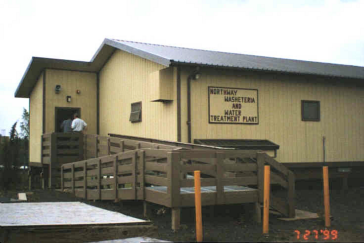
Northway is located in Southeast Fairbanks Census Area on the east bank of Nabesna Slough, 50 miles southeast of Tok. It lies off the Alaska Highway on a 9-mile spur road, adjacent to the Northway airport. It is 42 miles from the Canadian border in the Tetlin National Wildlife Refuge. Northway presently consists of three dispersed settlements: Northway Junction, at milepost 1264; Northway, at the airport; and the Native village, 2 miles north, encompassing 18 sq. miles of land and 2 sq. miles of water.
"The area was traditionally Athabascan, though road construction and the airport have brought a permanent non-Native population." [*CRA] Located in the Southeast Fairbanks Census Area.
"Northway Village is a traditional Upper Tanana Athabascan community, practicing a subsistence lifestyle. Traditions such as dancing, crafts, hunting, and trapping continue today." [*CRA] Located in the Southeast Fairbanks Census Area, between Nabesna River and Skate Lake, 1.5 mi. N of Northway, Alaska Range
Named by prospectors and reported as "Star City" in 1897 by Lieutenant W. P. Richardson, USA. A post office was maintained here from 1898 to 1902 (Ricks, 1965, p. 60). Site of mining camp, on left bank of Yukon River, 11 mi. N of Eagle, Yukon-Tanana High.
This village originated as a telegraph station, called 'Tanana Crossing,' where the telegraph lines crossed the river. When the telegraph was dismantled, it remained a village, and, upon the recommendation of the Bureau of Indian Affairs (BIA), in 1932 the name was contracted to Tanacross.
"Residents are Tanah (or Tinneh) Athabascan Indians. Most villagers relocated from Mansfield Village, Kechumstuk, and Last Tetlin in 1912 when Bishop Rowe established St. Timothy's Episcopal Mission. The village was originally located on the north side of the Tanana River and was called 'Tanana Crossing.' It is located where the Eagle Trail crossed the Tanana River. A trading post opened near the mission in 1912, and the St. Timothy's post office opened in 1920. More Natives moved from Mansfield when a formal school opened in 1932, although classes had been held at the mission. The name was eventually shortened to Tanacross. In the mid-1930s, an airfield was built across the river from the village. In 1941, the village gave the military permission to use its airfield as an emergency deployment post during World War II. The airfield was paved in 1942, and temporary camps were established. Thousands of troops were deployed through Tanacross airfield during the war. People of the village served as volunteer scouts and backup support for the army. After the war, the airfield was closed. In 1972, due to water contamination, the village relocated from the north bank of the Tanana River to the south bank. In 1979 the old village site burned when a grass fire spread out of control. Culture Tanacross is a traditional Athabascan village with a subsistence lifestyle." [*CRA] Located in the Southeast Fairbanks Census Area.
 "The
semi-nomadic Athabascan Indians have historically lived in this
area, moving with the seasons between several hunting and fishing camps. In
1885, Lt. H. T. Allen found small groups of people living in Tetlin and, to
the south, in Last Tetlin. The residents of Last Tetlin had made numerous
trips to trading posts on the Yukon River. In 1912, villagers from Tetlin
would trade at the Tanana Crossing Trading Post. During the Chisana gold
stampede in 1913, a trading post was established across the river from
Tetlin. When two trading posts were opened in the village during the 1920s
by John Hajdukovich and W.H. Newton, residents from Last Tetlin relocated to
Tetlin. A school was constructed in 1929, and a post office was opened in
1932. The 786,000-acre Tetlin Indian Reserve was established in 1930. An
airstrip was constructed in 1946. When the Alaska Native Claims Settlement
Act (ANCSA) was passed in 1971, the reserve was revoked. Tetlin opted for
surface and subsurface title to the 743,000 acres of land in the former
reserve. Due to the community's isolation, the residents are able to pursue
a traditional Athabascan culture and lifestyle." [*CRA] Located in the
Southeast Fairbanks Census Area.
"The
semi-nomadic Athabascan Indians have historically lived in this
area, moving with the seasons between several hunting and fishing camps. In
1885, Lt. H. T. Allen found small groups of people living in Tetlin and, to
the south, in Last Tetlin. The residents of Last Tetlin had made numerous
trips to trading posts on the Yukon River. In 1912, villagers from Tetlin
would trade at the Tanana Crossing Trading Post. During the Chisana gold
stampede in 1913, a trading post was established across the river from
Tetlin. When two trading posts were opened in the village during the 1920s
by John Hajdukovich and W.H. Newton, residents from Last Tetlin relocated to
Tetlin. A school was constructed in 1929, and a post office was opened in
1932. The 786,000-acre Tetlin Indian Reserve was established in 1930. An
airstrip was constructed in 1946. When the Alaska Native Claims Settlement
Act (ANCSA) was passed in 1971, the reserve was revoked. Tetlin opted for
surface and subsurface title to the 743,000 acres of land in the former
reserve. Due to the community's isolation, the residents are able to pursue
a traditional Athabascan culture and lifestyle." [*CRA] Located in the
Southeast Fairbanks Census Area.
Lieutenant Allen (1887, p. 77) wrote "We reached 'Tetling's' June 12, 1885 ... six men ... four women, and seven children, occuping two houses situated on a deep, clear stream, the outlet of a lake ...." Apparently named for the local tyone or chief "Tetling." Lieutenant P. G. Lowe (Glenn and Abercrombie, 1899, p. 370), USA, wrote: "On August 29, 1898 we stopped at 'Tetling,' and were met by Chief David .... 'Tetlings' consists of four log houses ...." In 1942, at the recommendation of Bureau of Indian Affairs (BIA), Board on Geographic Names (BGN) officially changed the spelling to "Tetlin" to agree with that of the river. Population 122. On Tetlin River, 4.5 mi. E of Tetlin Lake and 20 mi. SE of Tok, Yukon-Tanana High.
Local name published by U.S. Geological Survey (USGS) in 1951. Named because it marks the junction of two important highways in the Tetlin Indian Reservation. Description: On the N side of the Tanana River, at junction of Alaska and Taylor Highways, 8 mi E of Tok Junction and 13 mi NNW of Tetlin, Yukon-Tanana High
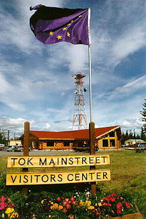 "It
is uncertain how Tok got its name. However, the nearby 'Tokai River'
was first reported in 1887 by Lt. Allen. 'Tok River' was recorded in 1901 by
the USGS. Tok began in 1942 as an Alaska Road Commission camp. So much money
was spent in the camp's construction and maintenance that it earned the name
'Million Dollar Camp' by those working on the highway. In 1944 a branch of
the Northern Commercial Company was opened, and in 1946 Tok was established
as a Presidential Townsite. With the completion of the Alcan Highway in
1946, a post office and a roadhouse were built. In 1947 the first school was
opened, and in 1958 a larger school was built to accommodate the many
newcomers. The U.S. Customs Office was located in Tok between 1947 and 1971,
when it was moved to Alcan at the border. Between 1954 and 1979, a U.S. Army
fuel pipeline operated from Haines to Fairbanks, with a pump station in Tok.
The pump station's facilities were purchased as area headquarters for the
Bureau of Land Management. The U.S. Coast Guard constructed a LORAN (Long
Range Aid to Navigation) station in 1976. Four 700' towers, located 6 miles
east of Tok junction, transmit radio navigation signals for air and marine
traffic in the Gulf of Alaska. In July of 1990, Tok faced extinction when a
lightning-caused forest fire jumped two rivers and the Alaska Highway,
putting both residents and buildings in peril. The town was evacuated and
even the efforts of over a thousand firefighters could not stop the fire. At
the last minute a "miracle wind" (so labeled by Tok's residents) came up,
diverting the fire just short of the first building. The fire continued to
burn the remainder of the summer, eventually burning more than 100,000
acres. Evidence of the burn can be seen on both sides of the highway just
east of Tok." [*CRA]
"It
is uncertain how Tok got its name. However, the nearby 'Tokai River'
was first reported in 1887 by Lt. Allen. 'Tok River' was recorded in 1901 by
the USGS. Tok began in 1942 as an Alaska Road Commission camp. So much money
was spent in the camp's construction and maintenance that it earned the name
'Million Dollar Camp' by those working on the highway. In 1944 a branch of
the Northern Commercial Company was opened, and in 1946 Tok was established
as a Presidential Townsite. With the completion of the Alcan Highway in
1946, a post office and a roadhouse were built. In 1947 the first school was
opened, and in 1958 a larger school was built to accommodate the many
newcomers. The U.S. Customs Office was located in Tok between 1947 and 1971,
when it was moved to Alcan at the border. Between 1954 and 1979, a U.S. Army
fuel pipeline operated from Haines to Fairbanks, with a pump station in Tok.
The pump station's facilities were purchased as area headquarters for the
Bureau of Land Management. The U.S. Coast Guard constructed a LORAN (Long
Range Aid to Navigation) station in 1976. Four 700' towers, located 6 miles
east of Tok junction, transmit radio navigation signals for air and marine
traffic in the Gulf of Alaska. In July of 1990, Tok faced extinction when a
lightning-caused forest fire jumped two rivers and the Alaska Highway,
putting both residents and buildings in peril. The town was evacuated and
even the efforts of over a thousand firefighters could not stop the fire. At
the last minute a "miracle wind" (so labeled by Tok's residents) came up,
diverting the fire just short of the first building. The fire continued to
burn the remainder of the summer, eventually burning more than 100,000
acres. Evidence of the burn can be seen on both sides of the highway just
east of Tok." [*CRA]
"The area was traditionally Athabascan, although the current population is primarily non-Native. Tok has become known as the 'Sled Dog Capital of Alaska.' Although residents have chosen not to incorporate as a municipality, there are numerous local volunteer committees for various community functions and various membership organizations." [*CRA]
Located in the Southeast Fairbanks Census Area, at the junction of Alaska and Glenn Highways, 8 km (5 mi) southwest of the junction of Tok and Tanana Rivers, and 19.3 km (12 mi) southeast of Tanacross, Alaska Range. Tok developed since the building of the Alaska and Glenn Highways in the 1940s.
*CRA Extracted from State of Alaska, Department of Commerce, Community, and Economic Development's, Community and Regional Affairs website.
Fairbanks AKGenWeb Copyright
Design by
Templates in Time
This page was last updated
07/21/2023