

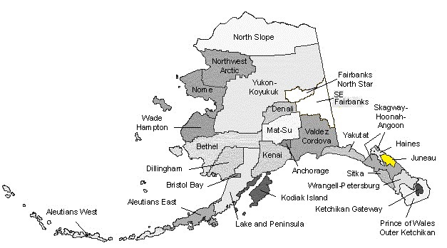
Juneau Borough
AKGenWeb

AMALGA - a former settlement and post office at the Eagle River Mine north of Eagle River, approximately four miles from tidewater and 22 miles northwest of Juneau. A miner's name apparently derived from the word amalgam. The mine, discovered in 1902, is in what was called Thane Mountain for Bartlett L. Thane, who was the mine superintendent. The 20-stamp mill and settlement were 900 feet below the mine and connected with it by cable tramway. The post office was established July 29, 1905. A horse tramway ran from the settlement seven miles to the beach at Amalga Landing on what is now known as Amalga Harbor, where the company had a wharf and warehouse. The mine operated for a number of years but in 1923 the stamp mill was moved to the Apex el Nido Mine at Lisianski Inlet. The Post Office may have been moved to Amalga Landing when the mine closed. It was discontinued in 1927.
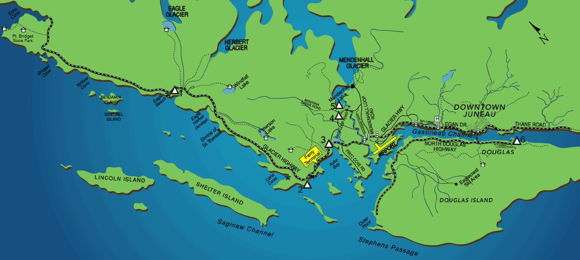
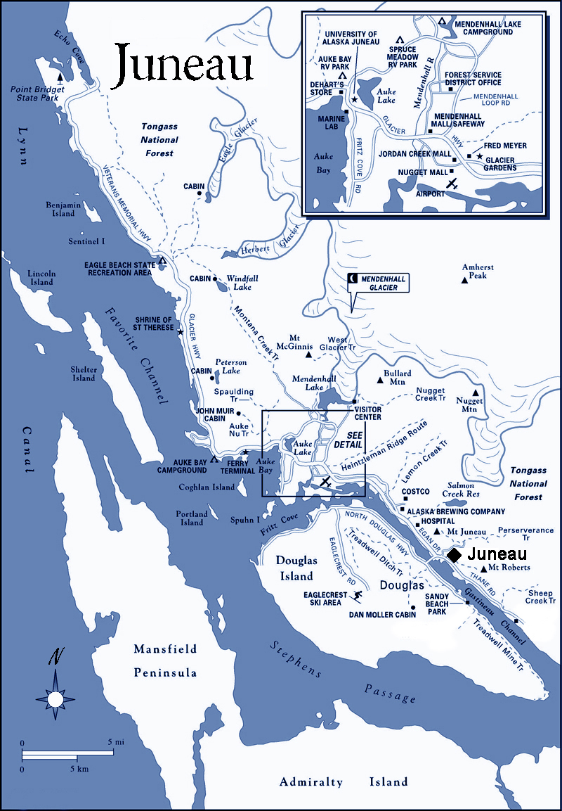
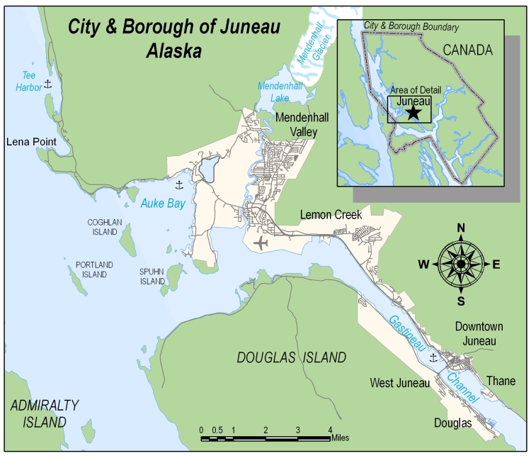
AUKE BAY - village, post office and voting precinct at Auke Bay, north of Juneau. The area began to be settled soon after Glacier Highway reached there in 1918. The census Bureau reported a population of 295 in 1950. The post office was opened on December 23, 1946, and the voting precinct was established in 1952.
AUKE VILLAGE - the site of the former village of the Auke Indians on the open bight just east of Point Louisa, 13 miles northwest of Juneau. The site, adjacent to Glacier Highway, has been reserved by the U.S. Forest Service as a recreation area. The 1880 census of Alaska listed the Auk population as 640, of whom 300 were on Admiralty Island, 50 on Douglas Island, and 290 on Stephens Passage, the latter presumably including those at the Point Louisa village. In 1890 the Census Bureau gives the population of "The Auk settlements" as 324 and in 1900 as 261, without specifying the number or location of the settlements. The village at point Louisa was known as Aukan, although in 1904 J. R. Swanton, the anthropologist, reported its name as Antogaltsu, meaning abandoned town. This may have been a recent name, given it after the population had moved to Juneau. Almost immediately after the founding of Juneau, Auk, Taku, and other Indians began moving to the new camp. The Auks were established on the beach just north of town and this became locally known as the Auk Village to distinguish it from the Taku Village, which was on the beach just south of town. Thereafter, the village at Point Louisa was usually called Old Auke Village.
DOUGLAS - an incorporated city on Douglas Island, from which it took its name, two miles south of Juneau. The town was established as a result of mining activity which commenced on the island early in 1881 and grew with the development of the Treadwell mines on its southeastern boundary. The first house in Douglas, a log cabin, was reported to have been built by William Newcomer in 1881. The community was for some time called Edwardsville, perhaps for H. J. Edwards, an early miner and resident. This name was in use at least as late as 1886. The post office, Douglas, was established on September 28, 1887, but the town was frequently called Douglas City. By 1890 the population was 402 and in 1900 it had reached 825. Douglas became an incorporated city on March 29, 1902. By 1910 the population had grown to 1722, but after that the town was struck by a series of disasters. A fire on March 9, 1911 destroyed 16 business buildings, including two hotels. On April 2, 1917, the Treadwell and Mexican mine workings were flooded when a portion under Gastineau Channel caved in and hundreds of men were out of work. By 1920 the population had dwindled to 919. Fire struck again on October 10, 1926, burning the entire eastern part of the town including the Indian village and most of adjoining Treadwell. In 1929 the population was 593. Another fire, on February 23, 1937, leveled a great deal of the remaining part of Douglas, including the school, post office, city hall and fire hall. The population by 1939 had dropped to 522. After that year it began to increase and in 1950 had reached 699. Douglas is currently part of the Juneau City and Borough. Douglas Island - is separated by Gastineau Channel from the mainland and by Stephens Passage from Admiralty Island. It is the 17th island in area in Southeast Alaska with an area of 78 miles in length and eight miles wide at its widest point with a shoreline measuring 42 miles. The island was named by the English explorer, Captain George Vancouver, in 1794 for John Douglas, then Bishop of Salisbury. Douglas was born at Fife, Scotland, in 1721. An author and ecclesiastic, he became Dean of Windsor in 1888 and Bishop of Salisbury in 1791 and held the latter office until his death in 1807. Point Salisbury on the mainland opposite the lower end of Douglas Island was also named for him. Ferry Way - a narrow street now running from South Franklin Street to Marine Way and the waterfront. Originally this was the approach to the wharf and float of the Juneau Ferry and Navigation Company and today it is the principal reminder of the passenger ferry service operated for many years between Juneau, Douglas, Treadwell, and Thane. Ferry service across the channel began soon after the opening of the Treadwell mines and was first conducted with rowboats and sailing sloops. By 1887 there was a steam ferry making three scheduled trips a day. At sailing time, however, the ferryman went around town blowing a horn and if too few customers showed up to make a trip pay, he postponed the sailing until the number increased sufficiently. Although there were several rival ferry companies at different times, the longest lived was the Juneau Ferry and Navigation Company which operated an number of vessels including the Lone Fisherman, Flosie, Teddy, Amy, and Alma. The last ferry trip was made on October 31, 1935, following the opening of the Douglas Bridge.
DU PONT CREEK - discharges into Gastineau Channel from the mainland 3.5 miles south of Thane. It was named for the DuPont Powder Company which built a powder magazine and wharf near the mouth of the creek in the summer of 1914 and stored powder there for the local mines until they closed. The miners called this Mission Creek for many years. E.W. Weisner of the Friend's Mission at Douglas claimed 640 acres along the beach, including the creek, for a mission in May 1889. It is not definitely known that a mission was established there, but some evidence indicates that there was.
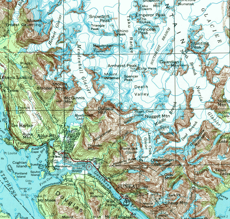
FISH CREEK - flows into Fritz Cove and drains a sizable valley on the northern end of Douglas Island. The name first appeared in the mining records on August 25, 1885, when the water of Fish Creek was claimed for use at the Treadwell Mines. It subsequently became the northern terminus of the great Treadwell Ditch. Homestead claims at the mouth of the creek were filed as early as 1800 and in later years a settlement, known as Fish Creek, grew up there. A school was established in 1937. Ferry Way - a narrow street now running from South Franklin Street to Marine Way and the waterfront. Originally this was the approach to the wharf and float of the Juneau Ferry and Navigation Company and today it is the principal reminder of the passenger ferry service operated for many years between Juneau, Douglas, Treadwell, and Thane. Ferry service across the channel began soon after the opening of the Treadwell mines and was first conducted with rowboats and sailing sloops. By 1887 there was a steam ferry making three scheduled trips a day. At sailing time, however, the ferryman went around town blowing a horn and if too few customers showed up to make a trip pay, he postponed the sailing until the number increased sufficiently. Although there were several rival ferry companies at different times, the longest lived was the Juneau Ferry and Navigation Company which operated an number of vessels including the Lone Fisherman, Flosie, Teddy, Amy, and Alma. The last ferry trip was made on October 31, 1935, following the opening of the Douglas Bridge.
GASTINEAU CITY - a short-lived realty development at the mouth of Nevada Creek on Douglas Island. In 1905 Mike Hudson, who had mining property on the creek, staked a 320 acre homestead at its mouth. In 1910 he subdivided this into lots, called it Gastineau City and offered free boat trips to the site so prospective buyers could make there selections. It is not reported that there were many buyers.
HUT POINT - at the northern end of Douglas Island on the east side of the mouth of Fish Creek. It was so named by Lieutenant F.M. Symonds of the U.S.S. Jamestown in 1880 from the fact that there were some Indian huts or houses on the point. A homestead claim filed there by Captain Vanderbilt of the Favorite the same year mentions the huts and the remains of log stockage or fort nearby.
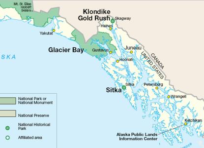
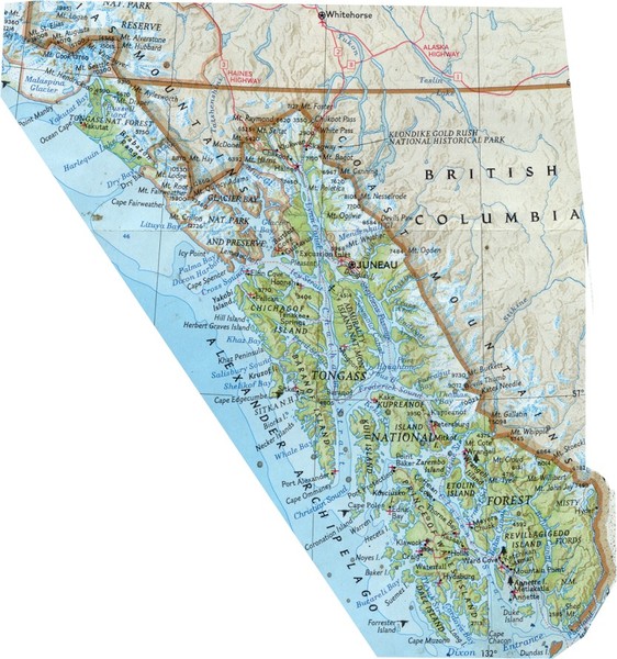
JUNEAU - Alaska's capital and currently its third city in population, is located on Gastineau Channel at Latitude 58 degrees 18 feet North, Longitude 134 degrees 24 feet west. The townsite was staked October 18, 1880, and settled in December of that year. The town had two names, Harrisburg and Rockwell, before December 1881, when it was named for Joseph Juneau. In the original record of the townsite location the name is spelled Harrisburgh. It is generally believed that Richard Harris, one of the two locators, named it for himself. In 1900 he wrote, however, that he named it for the capital of Pennsylvania. (See Harris Street.) On February 10, 1881, the miners at the new camp held a meeting "for the purpose of renaming Harrisburg." The name "Rockwell" received 18 votes, "Juneau received 15, and "Harrisburg" only one. In the meanwhile, two applications for a post office had been filed in Washington. One was sent by Wm. Gouveneur Morris, Special Customs Agent for Alaska, who asked that the post office be named Pilzburg for George Pilz, the mining engineer who had helped grubstake Joe Juneau and Richard Harris. The Post Office Department granted the second application which asked for the post office of Harrisburg and the office was established on April 8, 1881, with Edward DeGroff as postmaster. The town was scarcely five months old and already it had two names. The miners, to be safe, used both in their mining records, usually calling it "Rockwell" also known as "Harrisburg." Charles Henry Rockwell, for whom it received one of its names, was born at Chatam, Massachusetts, April 29, 1840. He entered the Navy in 1862 and took part in numerous engagements during the Civil War, receiving several promotions. In 1879 he was a lieutenant commander when he came to Alaska on the U.S.S. Jamestown. Early in 1881 he was sent to the new mining camp on Gastineau Channel with a detachment of 22 men to keep order and was active in establishing the town. The downtown area was laid out and platted by one of the Navy men, Master Gustave C. Hanus. In addition, Rockwell took up several mining claims and retained mining interests here for several years. He left Alaska in 1882, reached the rank of captain in 1899, and retired as a rear admiral in 1902. He died at his home in Chatham, Mass., in 1908. A brief biography of Richard T. Harris, the other man for which the town was first named, can be found under Harris Street. The town continued with its dual name until December 14, 1881, when, at another miners' meeting, it was moved that those present ballot on a new name. There were 72 ballots cast, of which 47 went to "Juneau City," 21 to "Harrisburg" and 4 to "Rockwell." Richard Harris moved to call another meeting for the express purpose of naming the town but lost on a vote of 23-43. The postmaster was requested to notify the Department of the action of the meeting and must have done so promptly for on January 10, 1882, the post office was officially designated Juneau. The Department dropped the "City" but local usage retained it for many years and one of the early newspapers was the Juneau City Mining Record. As the center of a mining district that extended to Windham Bay on the South, Berners Bay on the north, and Admiralty Island on the west, Juneau had a steady growth, reaching a population of 1253 in 1890 and 1864 in 1900. In 1910 it slumped to 1644 but it climbed back to 3058 in 1920, 4043 in 1929, 5729 in 1936, and 5956 in 1950. Joseph Juneau, for whom the town was finally named, was born in Canada near the city of Quebec in 1826. His family soon afterward moved to Wisconsin where an uncle, Solomon Juneau, had established himself in the fur trade. This uncle built the first log cabin on the site of Milwaukee. A park in Milwaukee was named for him and so was the city of Juneau, Wisconsin. Young Juneau grew up hunting and trapping in Wisconsin and in 1849 followed the gold trail to California. He engaged in mining and later acquired a ranch near Oakland where he raised horses. He gave that up to go prospecting again in Oregon, Idaho, and Montana, and is said to have moved north to the Omineca in 1870 and the Cassiar in 1875. In 1879 Joe Juneau was working in a store at Wrangell when Richard Harris arrived there from the Cassiar. The two acquired a canoe and prospected along the coast. One account says they first visited Gastineau Channel that year. They eventually reached Sitka, where Juneau staked a number of claims at Silver Bay and both men worked for George Pilz, who was attempting to develop a mine. Pilz and others grubstaked Juneau and Harris and sent them on a prospecting trip in the summer of 1880. They found gold at Silver Bow Basin and staked the beach as a townsite. Joe Juneau mined on Gold Creek for several years, getting rid of his gold dust about as fast as he took it from the ground. In the spring 1895 he went to Circle City and made a few thousands of dollars there. He went to San Francisco in the fall of 1896 and returned north to Juneau early in 1897, but soon left for the Klondike. In March, 1899, he died of pneumonia at Dawson. His remains were later returned to Juneau and he was buried in the Evergreen Cemetery on August 16, 1903.
LOUISA POINT - on the mainland just west of Auke Bay and 13 miles northwest of Juneau. The old Auke Village was located on the cove just east of the point. Point Louisa was named by Commander L.A. Beardslee of the U.S.S. Jamestown in 1880, but the source of the name is not recorded.
NEW BOSTON - a short-lived mining camp on the Douglas Island shore of Gastineau Channel at the mouth of Grant Creek, a mile and a half northwest of Juneau. It was also known as Union City. In 1887 the Alaska Union Mining Company, largely financed by Boston capital, began development of group of lode claims and built a wharf, bunkhouse and other buildings, an 80-stamp mill and a tramway to the mine which was some 1800 feet from the beach. In the neighborhood of $300,000 was reported to have been expended before it was discovered that there was no ore worth milling. The first and only clean-up was said to have yielded $40, after which the company went out of business.
NORWAY POINT - on Glacier Highway, just beyond the Juneau city limits. The origin of the name is not precisely known, but it is said to have been derived from a settlement of Norwegian fishermen in the area. One of them, Nels Pearson, had his homestead directly on the point. The name appeared in print as early as 1917 and was no doubt in local use for some time before that.
Juneau Borough AKGenWeb Copyright
Design by
Templates in Time
This page was last updated
09/27/2022