

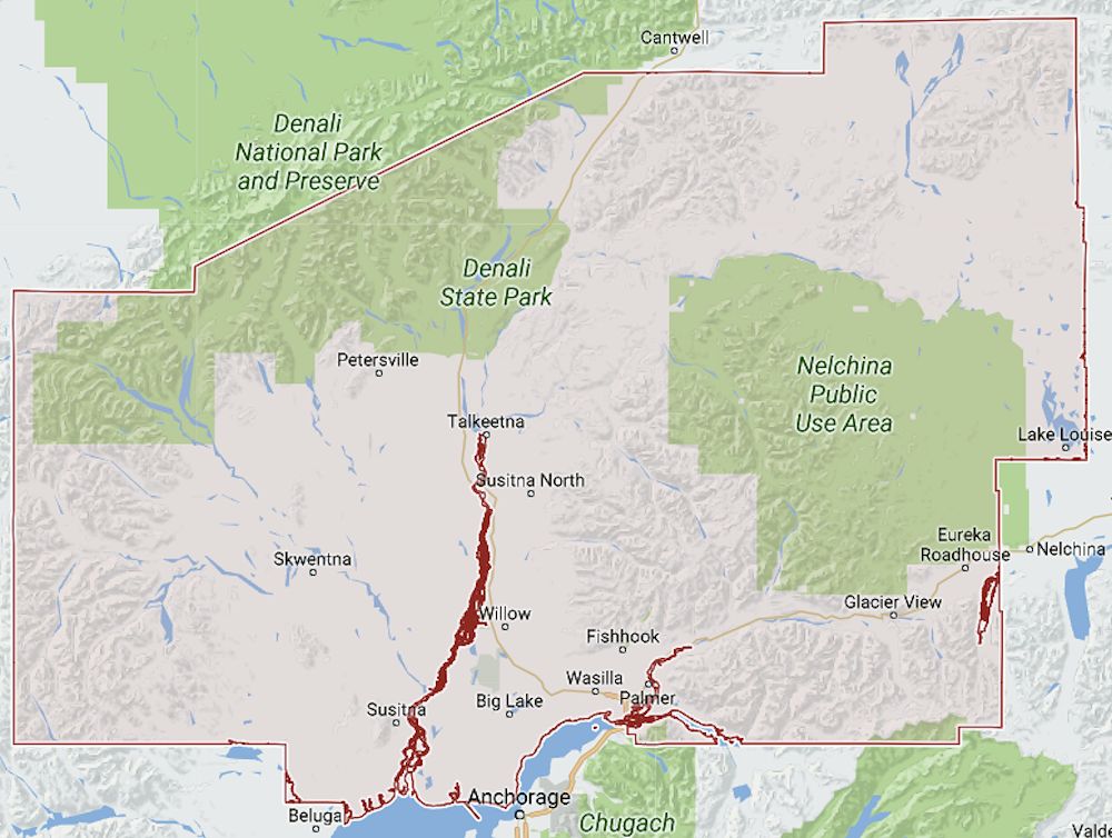
Matanuska-Susitna Borough AKGenWeb

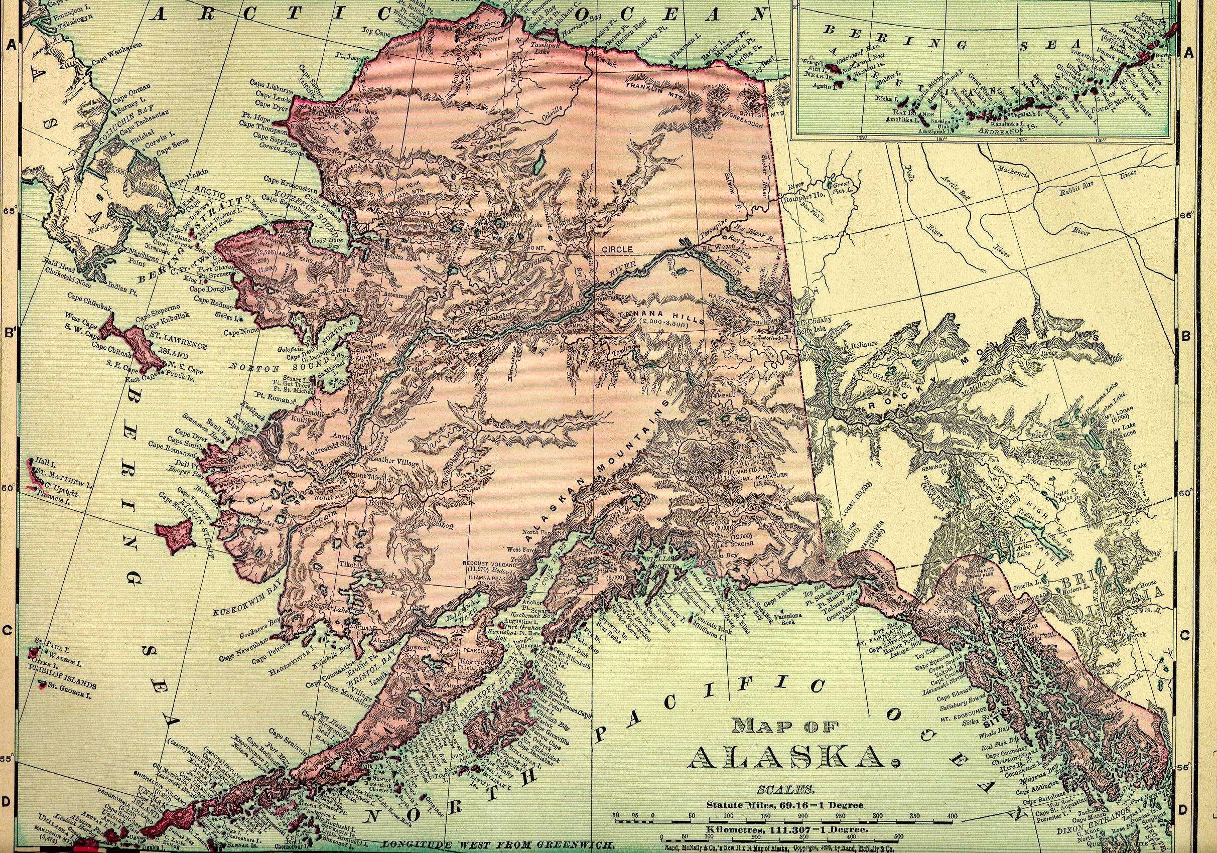
1895 Rand McNally Atlas
Courtesy of Pam Reitsch
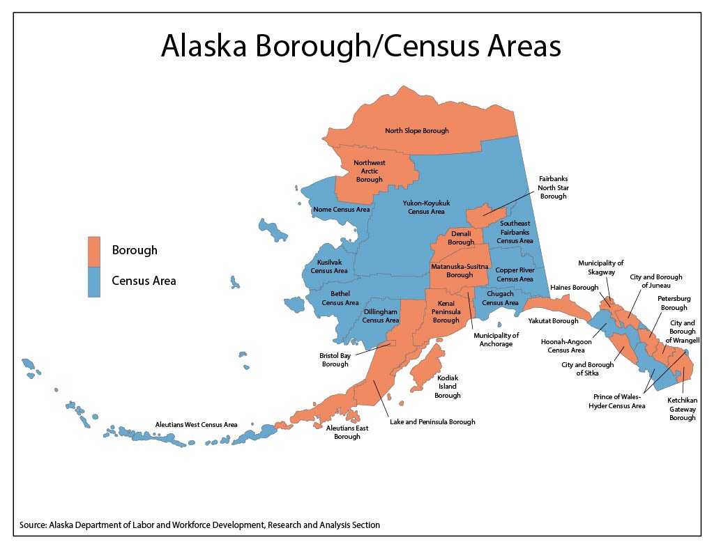
MatSu Borough Map
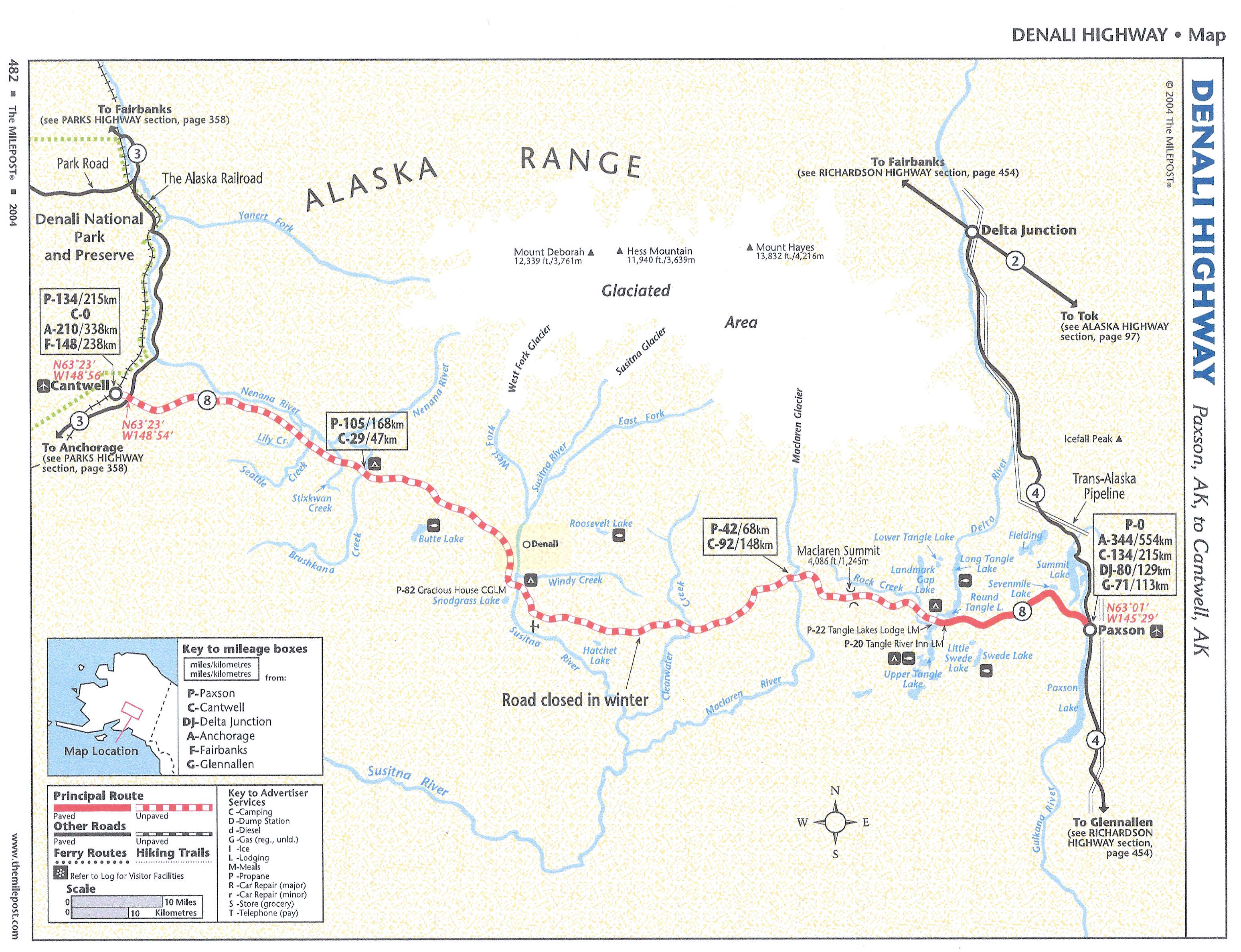
Denali Highway
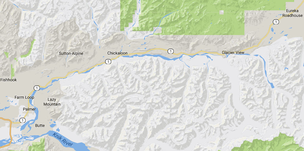
Glen Highway
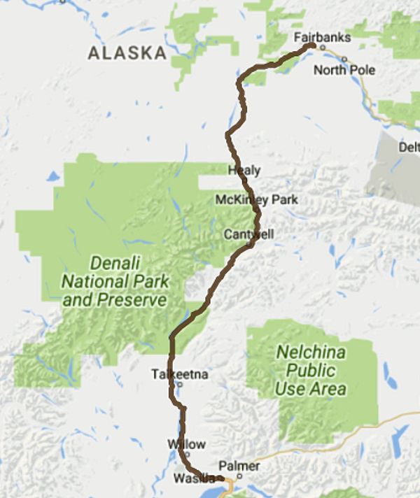
Parks Highway
Alexander – Village on Susitna River delta, near mouth of Alexander Creek, 27 mi. NW of Anchorage, Cook Inlet Low. This small Indian village was reported in 1898 by Eldridge*. The area is named in the 1910 census report.
Bay City – See John Fitzgerald Kennedy City below.
Big Lake – 2015 pop. 3815
Broad Pass – Pop 10, mile 304.3 on The Alaska RR in Broad Pass, 12 mi. SW of Cantwell and 45 mi. SW of Healy, Talkeetna Mts. Name taken from pass in which it is located; reported by The Alaska RR on its 1922 timetable.
Buffalo Soapstone – Located about 10 miles north of Palmer. As of the 2010 census there were 855 people.
Butte – pop 559, near Palmer, NE of Anchorage, Talkeetna Mts. Relatively recent development on Glenn Highway. Probably named for Bodenburg Butte.
Caswell – The Caswell post office was established in 1929; discontinued in 1931. It is located at mile 202.3 on The Alaska RR, 15 mi. N of Willow and 52 mi. N of Anchorage, Cook Inlet Low.
Chase – Railroad Station at mile 236.2 on the Alaska RR on E bank of Susitna River, 9 mi. N of Talkeetna, Cook Inlet Low. This flag stop was named in 1922.
Chelatna Lodge – Local name reported in 1945 by USGS. At S end of Chelatna Lake, 42 mi. NW of Talkeetna, Alaska Range.
Chickaloon – Pop 43. On Chickaloon River, 26 mi. NE of Palmer, Talkeetna Mts. Village named for the Chickaloon River. Was established about 1916 as the terminus of the Matanuska Branch of the Alaska Railroad in this coal-rich region. The Chickaloon post office operated from 1918 to 1922 and 1931 to 1933. Its pop was 28 in 1930. The Chickloon area is named in the 1900 and 1910 census reports.
Chulitna – This RR station was named in 1916 for nearby Chulitna River and has been in use since the opening of the line. At mi. 273.8 on The Alaska RR, 43 mi. NE of Talkeetna, Talkeetna Mts.
Cottonwood – Name of a roadhouse and camp reported by USGS in 1911. Located on E bank of Cottonwood Creek, 16 mi. SW of Palmer, Cook Inlet Low. Area is on the 1900 and 1910 census reports.
Curry – Pop 3, mi 248.5 on The Alaska RR, on E bank of Susitna River, 20 mi NE of Talkeetna, Talkeetna Mts. The Alaskan Engineering Commission Annual Report for 1916 lists the name Dead Horse for this camp along the Alaska RR route. As a RR station the name was changed in 1922 to Curry. It was named for Charles Forrest Curry, 1858-1935, of Sacramento, Calif. a member of Congress. It had a population of 44 in 1958, but this decreased rapidly after the closing of the railroad agency a year later.
Denali – Pop 4, E of Susitna River, near mouth of Valdez Creek, 67 mi SE of Healy, Alaska Ra. Mining camp established about 1907. A post office named "McKinley" existed here in 1908-09, and in 1910 R. H. Sargent* reported the camp name as "Valdez Creek." In 1922 a post office was again established, but this time it was called "Denali" the Indian name for Mount McKinley. Its 1940 population was 63
Eska – Pop 53, on Eska Creek, 12 mi NE of Palmer, Cook Inlet Low. Name of a mining community and railroad station on a branch of The Alaska Railroad. A post office was established here in 1917, discontinued in 1922, but reinstated in 1943 (Ricks*, 1965, p. 19).
Eureka – Site of mining camp, at Junc. of Pioneer and Eureka Creeks, 3 mi S of Dureka Dome and 23 mi S of Rampart, Yukon-Tanana High. This camp was established in 1899. A telegraph station called "Glen" was established here about 1904 and, in 1909, a post office called "Eureka" which was discontinued in 1918. (Ricks*, 1965, p. 20).
Eureka Roadhouse – Former roadhouse on Valdez Trail which is now Richardson Highway, along Ptarmigan Creek, 1.5 mi W of Ptarmigan and 21 mi NE of Valdez, Chugach Mts. Name published in 1909 by USGS.
Fishhook – Fishhook is a census-designated place in Matanuska-Susitna Borough, Alaska, United States. It is part of the Anchorage, Alaska Metropolitan Statistical Area. At the 2010 census the population was 4,679. Located NE of Wasila and NW of Palmer. 2015 pop. 5323.
Fort Liscum – [Dayville] Locality, on S shore of Port Valdez 4 mi. SW of Valdez, Chugach Mts.; 60 05' N, 146 21 W; Var. Dayville. Former military post established in 1900, reported to have been named for Colonel Liscom, USA, commander of the 9th Infantry during the Boxer Rebellion, who died of wounds in China just prior to the founding of this post. The Fort Liscum post office was established in 1900; discontinued in 1922. (Ricks*, 1965, p. 21).
Glacier View – 2015 pop. 249
Glen (Glenn) – See Eureka above.
Gold Creek – This is the site of a flag stop on The Alaska Railroad which derives its name from nearby Gold Creek. This name was published in 1922 on the official timetable of The Alaska Railroad. It was called "Susitna River Station" in 1921 by the Chamber of Commerce of Seattle, Washington and maybe the same location as "Susitna Station" in the 1910 Census. Mile 263.2 on The Alaska RR, 34 mi NE of Talkeetna, Talkeetna Mts. Listed in 1900 Census.
Houston – Also called Houston Siding. RR Station, mile 174.9 on The Alaska RR, 29 mi N of Anchorage, Cook Inlet Low. Name published on an Alaska Railroad blueprint map in 1917. Recent USGS maps indicate a site with two or three buildings but it was incorporated as a city in 1966. A June 1996 wildfire destroyed more than 37,500 acres (152 square km) in the Houston and Big Lake area, including 433 buildings and homes valued at $8.9 million.
Houston Siding – See Houston above.
John Fitzgerald Kennedy City – Village, pop. 35, on NW shore of Knik Arm Cook Inlet, 13 mi N of Anchorage, Cook Inlet Low. Location was named Bay City. On December 20, 1963 it was named by members of the Bay City council for John Fitzgerald Kennedy, 1917-1963, 35th President of the United States. Mr. Byron Mallott, State Commissioner of Community and Regional Affairs reported in 1973 that there were no residents in the area to verify the existence of the City. City was dissolved officially by the Alaska State Legislature in March, 1974 (Fairbanks Daily News-Miner, 4/24/73, p. 2) (Board on Geographic Names (BGN) files).
Jonesville – Village, pop. 97 (1950). E of Wishbone Hill, 11 mi NE of Palmer, Cook Inlet Low. Name of a RR station and former mining camp listed in the 1922 Railway Guide Index. A post office established here in 1921 and was discontinued in 1944 (Ricks*, 1965, p. 29).
Knik – Known by many names/spellings: Kinik, Kneep, Knick, Knuyk, Kook, Kweek, Kinnick, K'niq-a-mut, Palmers Store. Village, pop. 40 on W bank of Knik Arm Cook Inlet, 17.5 mi. NE of Anchorage, Cook Inlet Low. Listed in the 1900 Census and 1910 Census. Tanaina Indian village name, meaning "fire [igniq]," originally applied to a settlement of several villages at the head of Cook Inlet. The principal village (probably the one at the mouth of Knik River) was listed by Ivan Petroff* as "Kinik" and "Kinnick" with a pop of 46 in 1880 and 160 in 1890. The total number of "Kinik" Indians living in the area in 1900 was about 250, obtaining their subsistence by hunting, trapping and bartering. The present village called "Knik" developed around a trading post called "Palmers Store" in 1903. Its pop. was 118 in 1910; 40 in 1920; and 34 in 1930. The Knik post office was here from 1904 to 1919 (Ricks*, 1965, p. 35). See Eklutna above.
Kroto – Site of a Tanaina Indian village; reported by Eldridge* and Muldrow* (1900, map 3), USGS. Listed in the 1900 Census and 1910 Census. At junc. of Kroto Creek and Susitna River, 36 mi NW of Anchorage, Cook Inlet Low.
Lake Louise – The first recorded name of Lake Louise was Shosubenich, which means "great flat water with many islands". Later, and unconfirmed, it was named Lake Adah after a girlfriend of Lieutenant Joseph C. Castner an 1898 explorer for the Army. Later Captain Edwin Glenn changed the name to Lake Louise in honor of his wife. The U.S. Army established a recreation facility at the lake towards the end of World War II and built the first road into the area. Lake Louise road runs about 20 miles from the Glenn Highway to the lake. There are still several dilapidated cabins at the "Army Point" campground, including one that was used for four days by General Dwight D. Eisenhower before he was president. The lake is also home to the Lake Louise State Recreation Area. In 2015 the pop. was 45.
Lucky Shot Landing – In 1940, pop. 10. At junction of Grubstake and Willow Creeks, 15 mi NW of Palmer. Names came from a nearby Lucky Shot mining camp reported in 1942 by Army Map Service (AMS). A post office was established here in 1933, using just the name Lucky Shot, but was discontinued in 1942 (Ricks*, 1965, p. 40). Recent USGS maps indicate an airfield and five or six buildings at this site.
Matanuska – In 1940 pop. 87. Village established as a railroad station about 1914 and named for
the Matanuska River. A townsite was surveyed here in 1916 because this was the junction of the
main railroad line and the Matanuska Branch to the coal fields. Mi. 150.7 on The Alaska RR, in
Matanuska Valley, 5.5 mi SW of Palmer. A Matanuska River locality was enumerated in the 1900 Census
and was probably the forerunner of Matanuska.
"Matanuska AK The Russians applied the term mednovechka, 'copper,' to one of the rivers of the region,
because of metal found there, and that name was applied to the Indians living there. It was passed on to
the Americans, probably through the Indians, and ended in its present form, passing through a confusion of
spellings on the way." -- American Place Names by George R., page 284 Stewart
McKinley – See Denali above.
Montana – Originated as a railroad construction camp and was so named in 1919 by the builders. Homesteaders settled here in fall of 1957. Pop 39, mile 209.3 on The Alaska Railroad, 17 mi S of Talkeetna. Also called Montana Creek.
Nizina – Locality on Chititu Creek, 5 mi. SE of the junc. of Chititu Creek and the Nizina River, 14 mi. SE of McCarthy, St. Elias Mts.; 61 18 40" N, 142 37 30" W. Mining camp established in 1902. The Nizina post office operated from 1903 to 1926.
Palmer – Two early postcard photos of downtown and a church. Established as a railroad station on the Matanuska Branch of The Alaska RR about 1916. The Palmer post office was established in 1917; discontinued in 1925. The Warton post office operated here from 1931 to 1935, and was then changed back to Palmer in 1935 (Ricks*, 1965, p. 49, 50, 70). The town became the center of the Alaska Rural Rehabilitation Corporation (administered by the U.S. Department of the Interior), the supply center of a colony of about 180 farm families from midwest United States in the 1930's. Pop. was 150 in 1939 and 890 in 1950. It is thought to have been named for George Palmer, trader in the Knik Arm area in the late 1800's. 37 mi NE of Anchorage. 2016 pop. 7000.
Petersville – Mining camp reported in 1934 by USGS. Petersville Post Office was located here from 1936 to 1939 (Ricks*, 1965, p. 51). Located on Peters Creek, 24 mi NW of Talkeetna.
Point MacKenzie – Point of land, on S shore of Knik Arm, 3.4 mi. NW of Anchorage, Cook Inlet Low. Also spelled MacKinzie. Named by Joseph Whidbey of Vancouver* party on May 4, 1794 for the Right Honorable James Stuart MacKenzie (Wagner*). 2015 pop. 466.
Rogers Creek – Located on left bank of Susitna River, where The Alaska Railroad crosses Rogers Creek, 40 mi. N of Anchorage, Cook Inlet Low. Local name reported on 1917 railroad location manuscript map.
Skwentna – Pop. 16, on S bank of Skwentna River at its junc. with Eightmile Creek, 62 mi. N of Tyonek, Cook Inlet Low. Local name published in 1954 by USGS; derived from nearby river. A post oflice was maintained there from 1937 to 1939 (Ricks*, 1965, p. 59). 2015 pop. 42 [Coordinator Note: There is recorded elsewhere that the post office was maintained in 1968.]
Sunshine – Name listed as a flag stop on the railroad. Pop. 4, at mi 215.3 on The Alaska RR, 10 mi S of Talkeetna.
Susitna – Pop. 42, on E bank of Susitna River, 30 mi. NW of Anchorage, Cook Inlet Low. BGN 1962. Variety of names/spellings such as Susetna, Sushetna, Sushetno, Sushitna, Suchitna Station, Susitna Station. Petroff* listed the name "Sushetno" referring to a collection of 146 Kenai Indians �on and up the Sushetno River." The 1890 Census listed "Sushitna," population 142, and 27 houses. Swanton* (1952) referred to the village as Tanaina Indian. Susitna post office was established in 1906 and discontinued in 1943 (Ricks*, 1965, p. 63). In 1910 Census
Susitna North – 2015 pop. 1404.
Susitna River Station – See Gold Creek above. In 1910 Census.
Susitna Station – See Susitna above. Misspelled in 1900 Census. Listed in 1910 Census.
Sutton – History: RR station and siding on the Matanuska Branch of The Alaska RR founded about 1918. The Sutton post office was established in 1948 (Ricks*, 1965, p. 63). Description: population 162, on Glenn Highway, 11 mi NE of Palmer
Talkeetna – History: This is reported to be the site of a Tanaina Indian village. Its present name was derived from that of the river. It developed as a major camp when the railroad was built; the village obtained a post office in 1916. A railroad station was opened to traffic here in 1920. Its population was 70 in 1920; 89 in 1930; 136 in 1939; and 106 in 1950. Description: population 76, mi 226.7 on the Alaska RR, at junction of Talkeetna and Susitna Rivers, 80 mi N of Anchorage. It's enumerated in the 1910 Census Report. 2015 pop. 616.
Tanani
Tanani Villiage – Located Tanani Bay, at head of Chilkat Inlet, just S of Tanani Point, 14 mi. SW of Skagway. This is the name of a Tlingit Indian village said to mean "leaping place," reported by Aurel and Arthur Krause (1883, map) and published by USGS-US in the 1883 United States Coast Pilot (p. 200). In 1883 it consisted of three houses.
Valdez Creek – See Denali above.
Vault – Locality, on right bank of Vault Creek, 0.5 mi. E of Treasure Creek and 12 mi. N of Fairbanks, Yukon-Tanana High.; 65 01 N, 147 42 W. Name of a former mining camp published in 1907 by USGS. A post office was established here in 1908 and discontinued in 1909 (Ricks*, 1965, p. 69).
Wasilla – Wasilla is named after Chief Wasilla, a local Dena'ina chief. The name of a station on The Alaska Railroad that came into being about 1916. A post office was established here in 1917. Established at the intersection of the Alaska Railroad and Old Carle Wagon Road, the city prospered at the expense of the nearby mining town of Knik. Historically entrepreneurial, the economic base shifted in the 1970s from small-scale agriculture and recreation to support for workers employed in Anchorage or on Alaska's North Slope oil fields and related infrastructure. The George Parks Highway turned the town into a commuter suburb of Anchorage. Several state and federal agencies have offices in Wasilla. Wasilla gained international attention when Sarah Palin, who served as Wasilla's mayor before her election as Governor of Alaska, was chosen by John McCain as his vice-presidential running mate in the 2008 United States presidential election. 2016 pop. 9748.
Willow – The community got its start in 1897 when miners discovered gold on Willow Creek. Ships and boats brought supplies and equipment up Cook Inlet, landing at Knik or Tyonek. From Knik, a 26-mile summer trail went northwesterly. The trail along Willow Creek heading east became Hatcher Pass Road, currently an adventurous scenic road used during the summer tour season. In 1920, the Alaska Railroad built its Willow station house at mile 185.7 along the tracks leading from Seward to Fairbanks. During World War II, a radar warning station and airfield were built near the railroad tracks; a post office was established in 1948. By 1954, Willow Creek was Alaska's largest gold mining district, with a total production approaching 18 million dollars. Around 1970, before construction of the Parks Highway, Willow had a population of 78[2] until land disposals, homestead subdivisions, and completion of the George Parks Highway in 1972 fueled growth in the area. In 1976, Alaskans elected to move the state capital from Juneau to Willow in an effort to improve access for Alaskans while keeping the capital out of Anchorage but in 1982 election funding to move the capital was defeated so the capital remains in Juneau. Landscape architect M. Paul Friedberg created a master plan for the city as part of one such proposal. This fueled interest and land speculation in the area. More than half of the 1,500 cabins around Willow are for seasonal-use. Nearly all of the occupied homes in Willow are fully-plumbed, using individual on-site water wells, septic tanks and drain fields. Willow is now the official host of the Iditarod Trail Sled Dog Race restart. 2015 pop. 2085
Yentna River – In the 1900 Census. However, when researching, it is unclear as to the actual physical location of those in the Census as it covers a very large area.
Copyright © 1996 - The USGenWeb® Project, AKGenWeb, Matanuska-Susitna Borough

This page was last updated
06/19/2025