

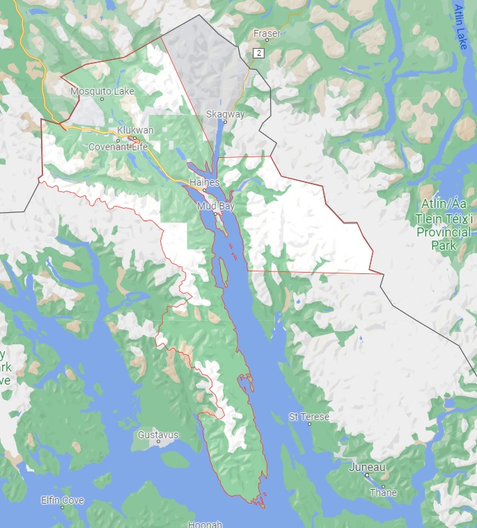
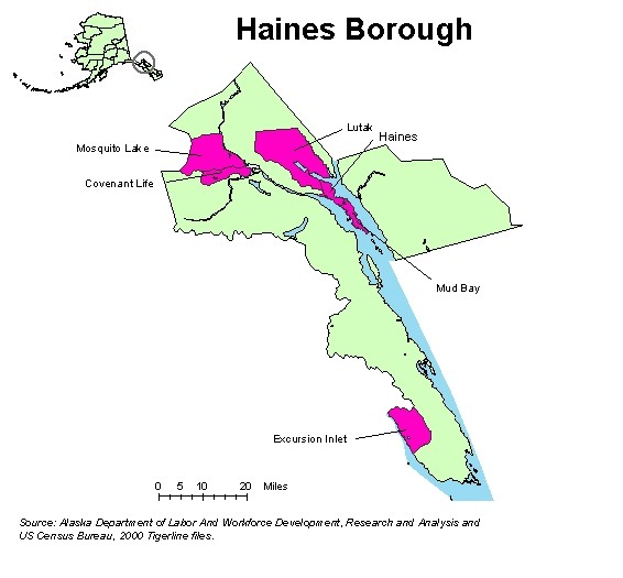
Haines Borough
AKGenWeb

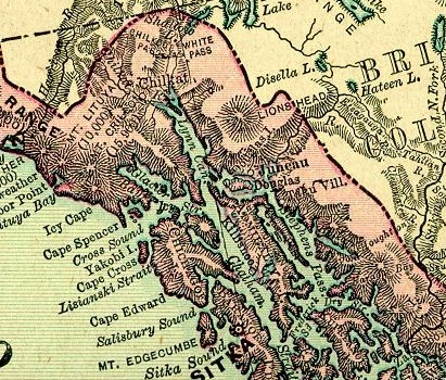
1895 Rand McNally Atlas
Courtesy of Pam Reitsch
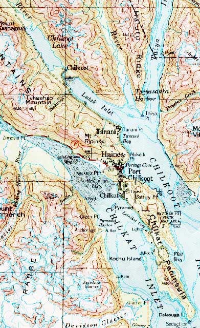
Topo Map
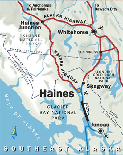
Courtesy of hainesak.com
History: Former Tlingit Indian village; abandoned about 1910. The name "Chilkat" refers to a tribe of Tlingit, and means "salmon storehouse." Description: on the Chilkat Peninsula, on E shore of Chilkat Inlet, 2 mi. S of the center of Haines, 18 mi. SSW of Skagway, Coast Range
History: Former Tlingit village named for the Chilkoot Tribe that lived there. In the 1880 Census Ivan Petroff listed "Chilcoot." The population in 1890, including the mission, was 106. In 1881 the U.S. Navy recorded "Chilcoot or Tananei." Aurel and Arthur Krause (1883, map) spelled the name "Tschilkut." Reported as "Tenany," an Indian fishing village, by C. M. Willard (1884, p. 140). Description: between Lutak Inlet and Chilkoot Lake, in course of Chilkoot River, 12 mi. SW of Skagway, Coast Mts
A Christian religious community located in the northern part of Haines Borough, west of Klukawan, between the Klehini River and the Tsirku River, and the Chilkat River and Mosquito Lake.
Located in southern Haines Borough, bordering Glacier Bay National Park, Excursion Inlet is a community with about a dozen residents.
Was where the Haines Airport is now located; former Tlingit Indian village; name obtained in 1880 from an Indian interpreter, as "Gan-te-gas-tak-heh," meaning "village on right bank of river," by Marcus Baker, U.S. Coast and Geodetic Survey (USC&GS). In the 1880 Census, Petroff (1884, p. 31) listed "Yondestuk," population 171; and in the same year, Captain L. A. Beardslee, U.S. Navy (USN), recorded the name "Tondust." The present inhabitants call it "Yindastuki." In 1867 this Indian village consisted of 12 houses; 13 years later it had grown to 16 houses and 171 people. In 1952 only a few houses remained.
Located on the west shore of Portage Cove, 16 miles SW of Skagway. Former incorporated City of Port Chilkoot merged with Haines in March 1970; named Haines in 1884 for Haines Mission, originally established in 1881 as Willard Mission by Presbyterian missionaries; earlier the place had been known as Dtehshuh (Indian village name meaning "end of the trail").
Name of an Indian village reported as "Katkwaltn" by USGS in 1898. Village "was abandoned over 60 years ago after being inundated during a flood." Robertson reported the full native name as "Kahtkwaltoo," which means "armour of wooden sticks", referring to the armour worn by a Kulkwan chief. Located on site of an Indian village, on Haines Highway, 5 mi. SE of Wells and 20 mi. SW of Skagway.
Located in northern Haines Borough. Within Lutak was the former Tlingit village of Chilkoot.
Located in northern Haines Borough. It takes its name from Mosquito Lake, a small water body next to the Chilkat River in the eastern part of the community.
Located in central Haines Borough. This small community, this small community is not to be confused with another Mud Bay, which is a suburb to the northwest of Ketchikan.
Now a section of the City of Haines, this formerly incorporated City of Port Chilkoot merged with Haines in March 1970; originally named Fort William H. Seward in 1904 by the War Department; in 1922, the name was changed to Chilkoot Barracks for the Chilkoot Indian tribe; about 1943 private citizens purchased the land and renamed it Port Chilkoot.
Was located on Tanani Bay, at the head of Chilkoot Inlet, just south of Tanani Point, 14 miles southwest of Skagway. This is the name of a Tlingit Indian village said to mean "leaping place," reported by Aurel and Arthur Kruase (1883, map) and published by U.S. Coast and Geodetic Survey (USC&GS) in the 1883 Coast Pilot (p. 200). In 1883 it consisted of three houses.
Located on E shore of Chilkat River, 1.8 mi. NW of Klukwan and 22 mi. W of Skagway. The name was reported by Wright (1904, pl. 2 and pl. 11), U.S. Geological Survey (USGS). A mining office was established here in 1900, and in 1903 it was a post for the Northwest Mounted Police on what was then the provisional boundary between the United States and Canada.
Copyright © 1996 - The USGenWeb® Project, AKGenWeb, Haines Borough

This page was last updated
06/18/2025